Secrets of the Viaducts: Walking the London Bridge to Greenwich Arches (Part Five)

* * *

After bridging the London Overground tracks, the arches of the London to Greenwich Railway cross Landmann Way; an isolated industrial road named after Thomas Landmann who first envisioned the pioneering viaduct in the 1830s.
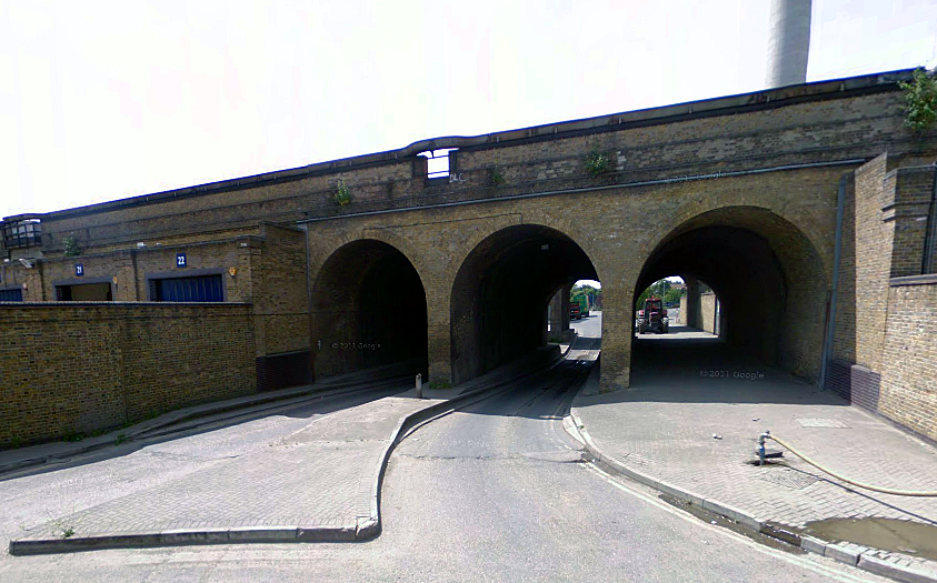
Landmann Way (image: Google).
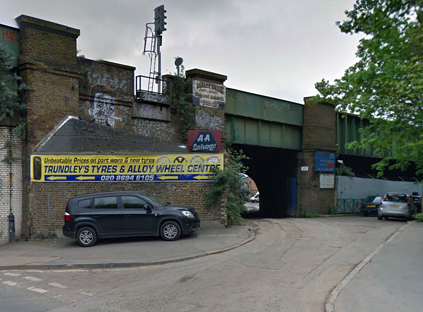
The arches then approach the junction of Trundleys, Grinstead and Surrey Canal Road.
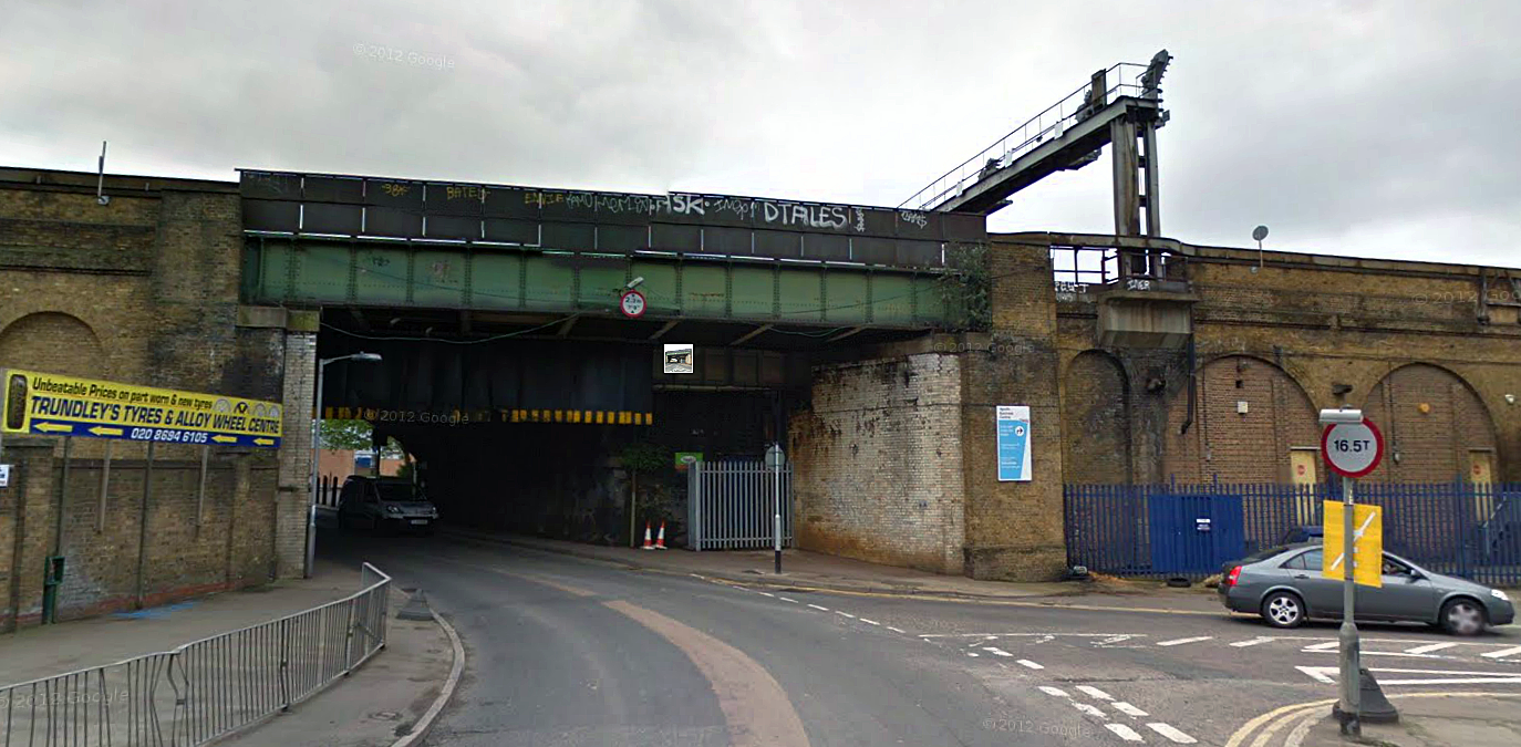
Trundleys/Grinstead Road junction (image: Google).
The Grand Surrey Canal
The route traced by Surrey Canal Road wasn’t originally a road at all- it was a waterway; part of the 2 ½ mile long Grand Surrey Canal which opened in 1810 for the purpose of transporting timber.
The Grand Surrey Canal (image: putitonmap.org)
Linked to the Thames at Rotherhithe’s Greenland Dock, the canal’s route headed directly south, passing beneath the London and Greenwich railway arches before turning onto the stretch covered by the now tarmacked over Surrey Canal Road.
The waterway then headed along the present day Verney Road, passed underneath the Old Kent Road and then on through the area now occupied by Burgess Park before terminating at a basin between Albany Road and Addington Square in Camberwell.
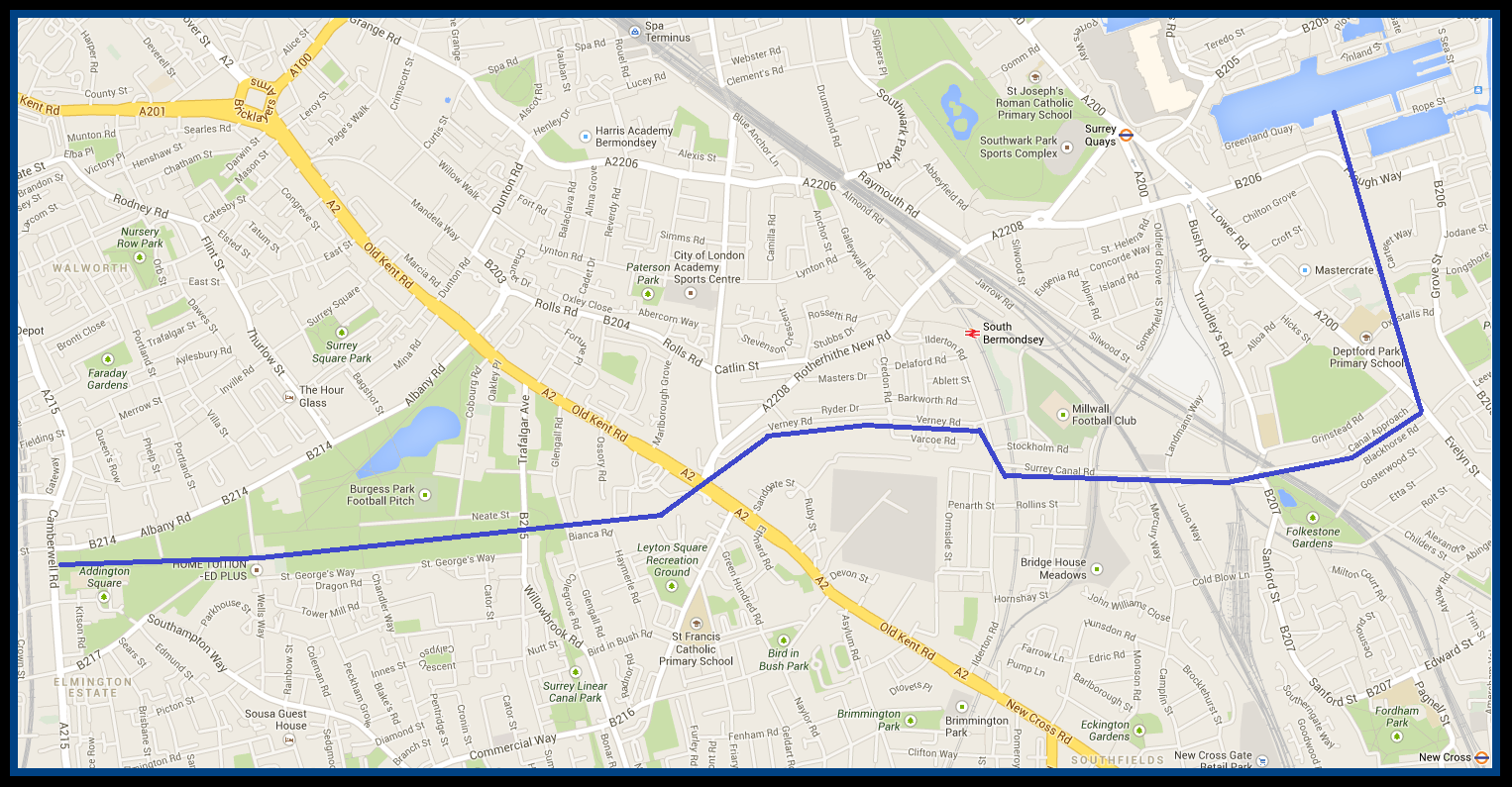
The approximate route of the former Grand Surrey Canal (please clink to enlarge).
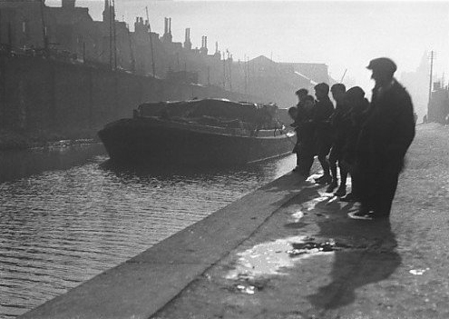
The canal carried freight well into the 20th century but as the decades wore on, it began to receive increased competition from road transport.
Between the 1940s and 1970s, the canal was gradually closed down section by section, leaving a collection of muddy, rubbish-strewn troughs in its derelict wake.
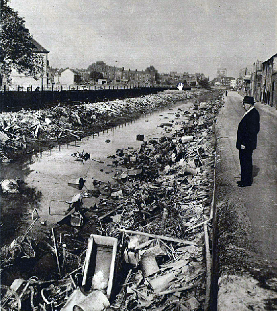
The state of the canal near Wells Way (Burgess Park) as it appeared in 1960. (Image: The London Illustrated News).
In the 1980s the obsolete trench was filled in; its route transformed into paths and roads which have pretty much erased all trace of the former canal.
However, if you know where to look there are a few clues here and there as the following images illustrate:

Former canal bridge on Evelyn Street. The filled in area below is now occupied by industrial units. (Image: Google).
Canal Approach, off of Trundleys Road. The curved road here indicates the path once wound by the canal as it passed beneath the railway viaduct. On Canal Approach, it is still possible to spot the odd mooring ring buried in the dirt… (Image: Google).

Surrey Canal Road, a route which was once deep under water… (Image: Google).

Satellite view of the Canal’s old route through Burgess Park; now converted into a footpath (image: Google).
*
A Further V2 Catastrophe
After the Trundleys Road junction and close to where the canal once flowed, the London to Greenwich arches run past a small park called Folkestone Gardens.

Folkestone Gardens (Image: Google).
The land now covered by Folkestone Gardens once bustled with streets and housing.
However, at 3.20am on the 7th March 1945 the site was struck by a V2 rocket, the huge explosion destroying much of the housing stock and killing 53 people.
Most of the fatalities were railway employees and their families, housed in flats owned by the Southern Railway.
The bombsite remained until 1970 when the rubble was cleared away and the peaceful green spot laid out.
*
Cold Blow Lane’s Cold War Politics
Shortly after passing beneath the viaduct, Trundleys Road becomes Sanford Street, off of which branches Cold Blow Lane.
On the corner of Sanford Street and Cold Blow Lane, you’ll spot a bold mural entitled Riders of the Apocalypse, painted on the end terrace of the Sanford Housing Co-op.
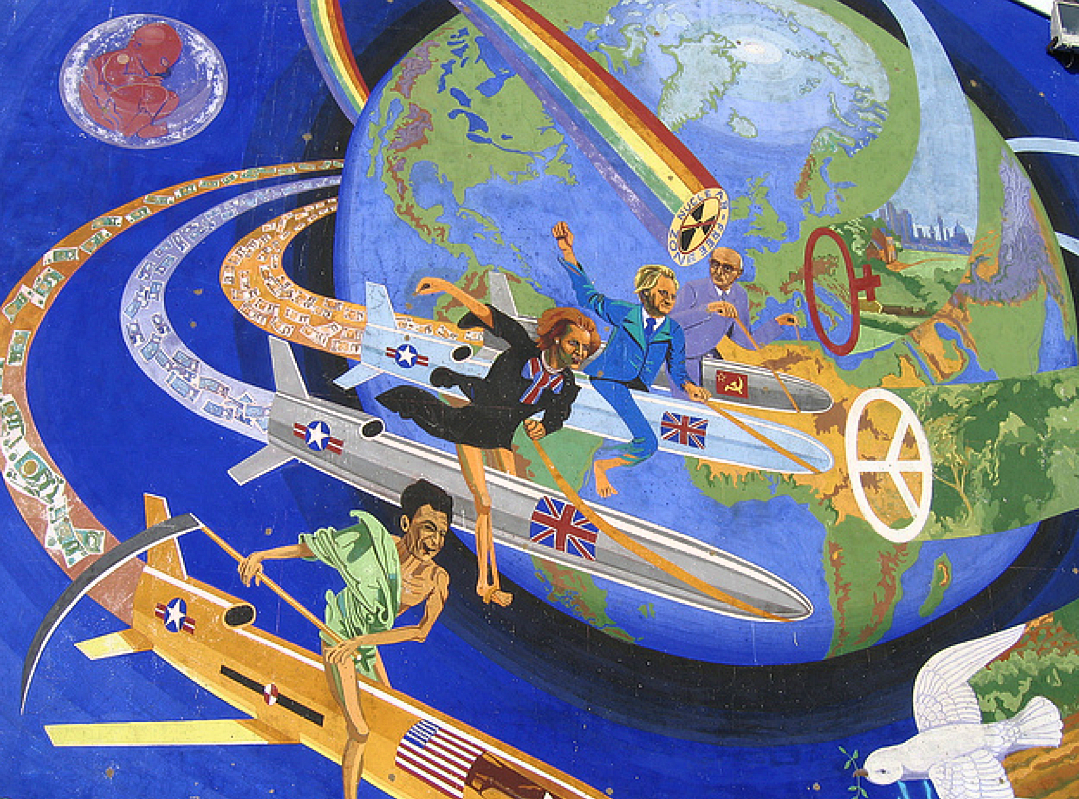
Riders of the Apocalypse (Image: London Murals website).
Created by Brian Barnes in 1983 when the cold war was decidedly chilly, the mural depicts Ronald Regan, Margaret Thatcher, Michael Heseltine (UK minister for defence at the time) and Soviet leader, Yuri Andropov, jockeying recklessly around the world on nuclear-tipped cruise missiles; a controversial weapon at the time due to its deployment on British soil at RAF/USAF bases Greenham Common and Molesworth.
The mural was a sequel to another of Brian Barnes’ south London murals… the terrifying Nuclear Dawn which was unveiled on Brixton’s Coldharbour Lane in 1981.

Nuclear Dawn; Brian Barnes’ other south London anti-war mural, pictured here in 1981 (Image: djfood.com).
Today, Nuclear Dawn can still be seen but is in a far sorrier state than its Deptford counterpart. There is currently a campaign to save it- please click here to learn more.
Deptford Station; Old Man of the Network
As we’ve seen in previous posts, in its first year the London and Greenwich Railway only ran a short distance between Spa Road and Deptford before being extended to London Bridge a year later; a quirk of history which granted Spa Road the accolade of being the capital’s first official railway terminal.
Spa Road has long since closed… but the Deptford stop is still very much in operation, essentially making it London’s oldest station to remain in service- and pretty much the world’s oldest working suburban station.

Deptford Station in the 1920s (Image: Old Deptford History).
For many years, the station was from salubrious, characterized by dingy stairwells and small, cramped brick buildings.

Deptford Station shortly before its recent redevelopment.
However, in the past two years Deptford Station has undergone a drastic re-development, with a brand new forecourt introducing much needed doses of light and air.

Deptford Station today.
*
The Deptford Project
On the high street, just over 100 yards south of the station, there sits The Deptford Project, based in the grounds of a former railway yard which was once annexed to Deptford Station.

The centrepiece of this refreshing community centre is a decommissioned 1960s train carriage which has been jazzed up and converted into a quirky café- I can safely vouch that the food and coffee served here is pretty marvellous!

The Deptford Project Carriage.
The 35 tonne carriage has held pride of place on Deptford High Street since 2008 after being carefully towed by road from Essex at the achingly slow speed of two miles per hour.
When the carriage passed beneath the Deptford Station arch, there were just a nail-biting two inches to spare…

The carriage arrives in Deptford (Image: The Deptford Project).
*
Rockin’ Out of Deptford

As the viaduct heads further south, the arches become neater and more diminutive.
After departing Deptford Station, trains on the London to Greenwich arches brush past the Crossfield Housing Estate which, despite appearing pretty run of the mill, actually boasts some surprising links with the history of British pop-music….

Looking towards the Crossfield Estate through the railway arches.
In the late 1970s, one of the estate’s blocks- Farrer House, which sits right beside the viaduct on a road known as Creekside, was deemed by the local council to be unsuitable for housing those with families.
Farrer House (Image: Google).
Consequently, the accommodation was offered to young, single tenants; many of whom happened to be struggling artists and musicians.
Amongst these down-at-heel residents were a number of performers from Deptford based band Squeeze (for whom Jools Holland was famously the original keyboard player).

Squeeze single cover, 1980.
Very much a quintessentially London band, Squeeze went on to have success in both the UK and the USA with songs such as Cool for Cats, Tempted and the bittersweet classic, Up the Junction which can be heard below:
Around the same time, Farrer House was also occupied by the fledgling band, Dire Straits.

Dire Straits, 1978 (Image: Wikipedia).
In 1977, the Crossfield Estate provided the unlikely setting for Dire Straits’ first ever gig.
With the Deptford Music Festival in full swing outside, the band decided to plug their instruments into the flat’s electrics, trail the wires outside and preform an impromptu set on the lawn.
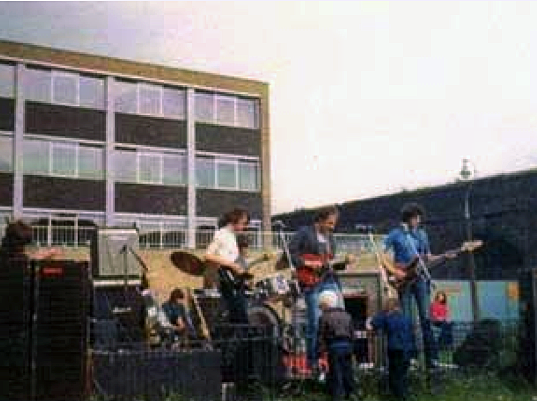
Dire Straits playing their first gig right beside the London to Greenwich arches, 1977. (Image: News Shopper).
Like Squeeze, Dire Straits were a regular act on Deptford’s club and pub scene, playing in venues such as The Duke and The Bird’s Nest before hitting the bit time.
The atmosphere of this south London pub scene was evoked in Dire Straits’ 1978 hit, The Sultans of Swing (please click below to listen):
In 2009 a plaque was unveiled on Farrer House by the Performing Rights Society to commemorate Dire Straits’ earliest gig.

Dire Straits Plaque (image: London Remembers).
The band is also linked to mural entitled Love Over Gold (the title of a Dire Straits album and single) which was painted outside Farrer House in 1989.

The Love Over Gold Mural.
Commissioned by the Inner London Education Authority and Dire Straits themselves, the mural was painted by local youngsters in support of Outset UK; a now sadly defunct charity which had been established to help disabled people.

A train crossing the London to Greenwich viaduct on the Love Over Gold mural.
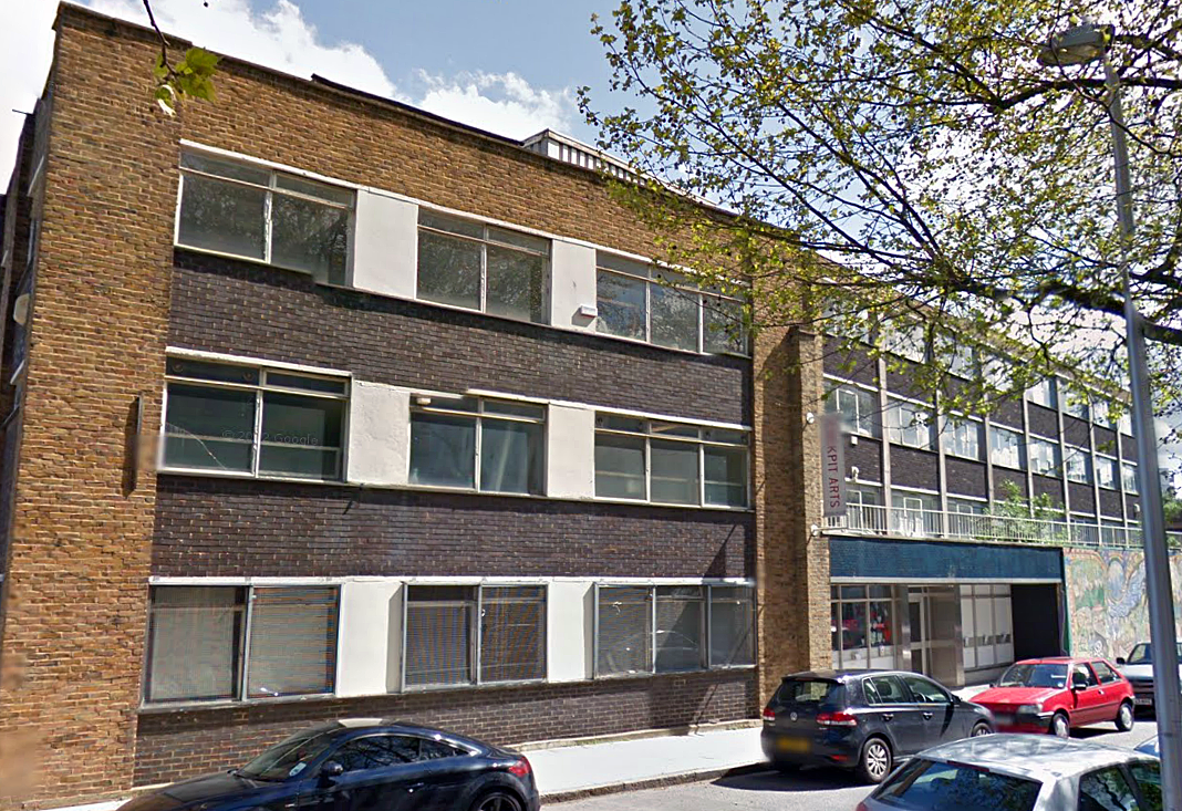
Today, Farrer House maintains its artistic links thanks to the Cockpit Centre, to which it is now home.

Farrer House today… now the Cockpit Arts Centre (Image: Google).
*
Dancing in Deptford
Creekside is also home to the Laban Dance Centre; a major college of dance and arts named after its founder, Rudolf Laban.

The Laban Centre, Creekside (image: Google).
Born in Austria-Hungary in 1879, Rudolf Laban opened a number of schools across Europe, pushing dance towards the level of accepted art form.

Rudolf Laban
Following the rise of Nazism, Laban fled to Britain in 1938 and, ten years later, opened a dance school in Manchester; the genesis of the centre which now stands in Deptford.
Designed for a competition in 1997 and unveiled in 2002, the current Laban Centre on Creekside is the world’s largest purpose built dance school and one of London’s most intriguing examples of contemporary architecture.
It was designed by Swiss architects, Jacques Herzog and Pierre de Meuron- the team who also masterminded the conversion of the Tate Modern and the design of Beijing’s 2008 Olympic stadium.

The Laban Centre (Image: wikiarquitectura).
*
History in the Making
Creekside itself takes its name from Deptford Creek; the point at which the 11 mile long Ravensbourne River enters the Thames.
As it approaches Greenwich, the railway viaduct crosses this body of water.
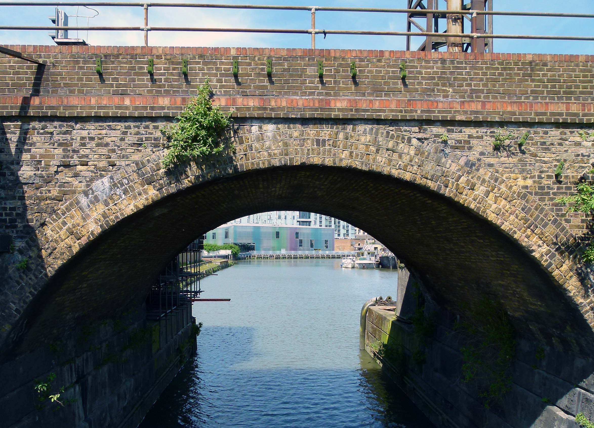
The arches cross Deptford Creek.
It was at Deptford Creek in 1580 that The Golden Hind finally came to rest after its monumental circumnavigation of the globe. Shortly after its arrival, Queen Elizabeth I boarded the ship to bestow a knighthood upon the captain, Francis Drake.

Francis Drake being knighted aboard the Golden Hind at Deptford (Image: reformation.org).
*
And now the end is near…
After crossing the Thames tributary the three and a half mile long viaduct finally begins its descent into Greenwich; our final destination on this tour.

Approaching Greenwich…
The arches reached Greenwich in December 1836 and the handsome station building, designed by architect George Smith, dates from 1840.

Greenwich Station.
As well as helping commuters travel back and forth between the city, Greenwich station was also instrumental in encouraging poorer Londoners to take daytrips away from the squalor of the city centre.
Today, the pleasant district remains a popular destination, noted for its seaside like atmosphere.
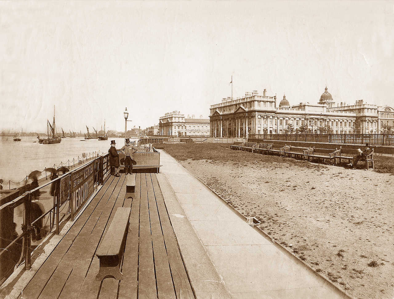
Greeniwich Pier, pictured in 1890 (image: oldukphotos).
Back in the ticket hall of the station, a small plaque hangs quietly on the wall, commemorating the railway’s place in the capital’s history.

* * *
Secrets of the Viaducts: Walking the London Bridge to Greenwich Arches (Part Four)
This is part four in a series examining the history on and around the arches of the London and Greenwich Railway viaduct which was constructed in the 1830s.
To read part one, please click here.
To read part two, please click here.
To read part three, please click here.
* * *

Under the shadow of the V2s
The point at which the London Bridge to Greenwich viaduct spans the junction of Drummond Road and Southwark Park Road is known locally as ‘John Bull Arch’; a reference to a pub which once stood nearby.
John Bull Arch
In the autumn of 1944 the original arch and its namesake pub were wiped out in two V2 rocket attacks which, although occurring several days apart in late October and early November, managed to strike the exact same spot in an extremely unlucky twist of fate.
A total of 11 civilians were killed by the blasts.
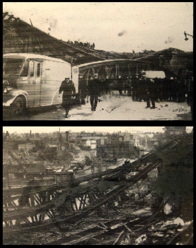
The destruction of John Bull Arch, 1944 (images: John Harvard Library).
Built in subterranean slave labour camps, the V2s (‘V’ standing for ‘Vergeltungswaffe’… ‘Retaliation weapon’) were the world’s first ballistic missiles.
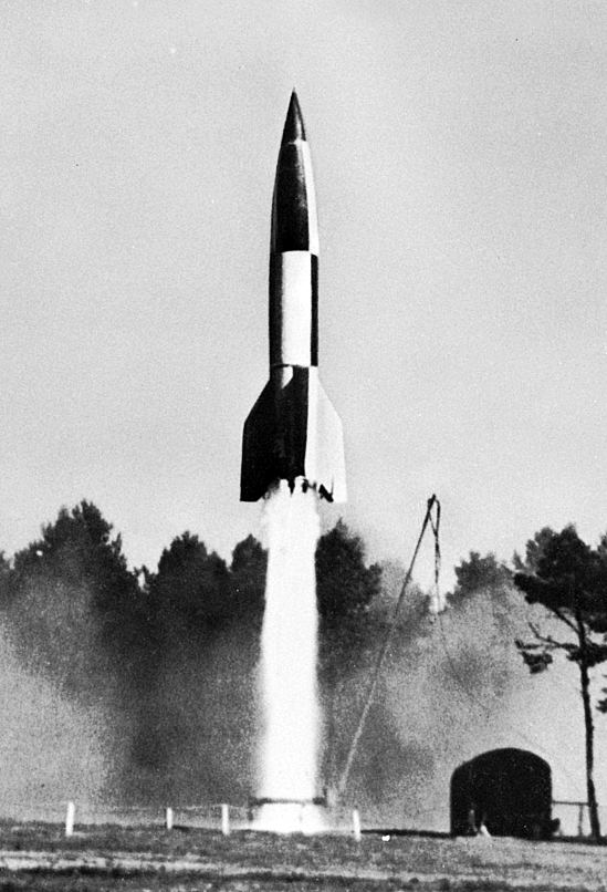
A V2 Rocket launch.
After being fired from Nazi occupied territory, the fearsome 13 tonne rockets would soar into sub-orbital spaceflight before hurtling back down towards their target at over 3,000 miles per hour- almost four times the speed of sound which meant no warning could be given of the terrifying weapon’s approach.
By the time the sonic boom and explosion cracked through the air, most of the rocket’s victims would already be dead.
During the final years of WWII, over 1,400 V2s were launched towards Britain, 500 of which were aimed at London.
The capital’s southern suburbs suffered greatly under the rockets; primarily due to the influence of Eddie Chapman; a former safecracker and Wormwood scrubs inmate whose roguish nature made him the ideal double-agent during the war.

Eddie Chapman, the double agent who undermined the Nazi’s missile campaign (Image: The Times).
During the V1 and V2 campaigns, Eddie fed the Nazis misinformation regarding the accuracy of Hitler’s vengeance weapons, leading the enemy to believe that their missiles were striking their intended targets in central London; a ruse which reduced their impact on Britain’s war effort and no doubt saved a great many from being killed and injured.
Tragically though, this meant that those in the suburbs had to bear the brunt of the deception’s consequences.
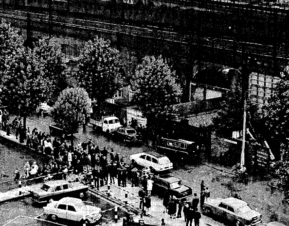
The worst V2 attack on England occurred on November 25th 1944 on New Cross Road, just 1.5 miles south of the John Bull Arch which had been smashed a few weeks before.
At 12.26pm that afternoon, the New Cross branch of Woolworths suffered a devastating V2 strike whilst packed with shoppers who’d rushed to the store after hearing that a supply of saucepans- rare and coveted during the days of rationing- were in stock.
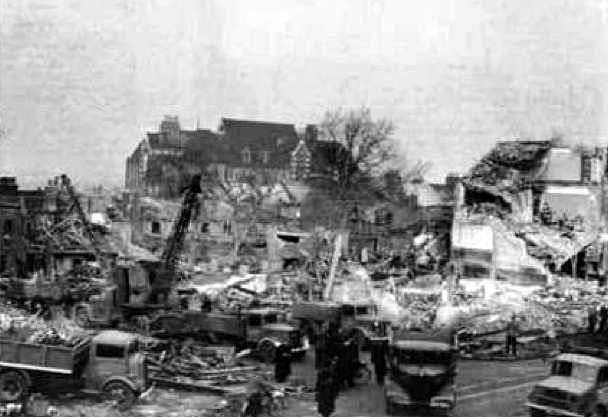
Aftermath of the devastating V2 strike on Woolworths, New Cross Road, 1944.
168 people perished in the blast with a further 121 seriously injured. The site today is now home to a branch of Iceland.

Site of the New Cross V2 catastrophe (image: Google Streetview).
*
The chief developer behind the V2 rocket was Wernher Von Braun; the scientist who famously went on in later years to work for NASA where his expertise led to the design of the Saturn V moon rocket.

Wernher Von Braun, a reluctant destroyer.
Despite his work for the Nazis, the regime was deeply suspicious of Von Braun.
In 1943 he was arrested and imprisoned by the Gestapo for concentrating his research on peaceful rather than military purposes; a mind-set which was considered a crime against the state. The scientist was also accused of plotting to flee Germany, taking his secrets to the allies.
It was only thanks to the intervention of high ranking Nazi, Albert Speer- who insisted that Von Braun was their only chance of obtaining rocket technology- that the scientist was spared.
Forced to gear his ideas towards the delivery of death and destruction, Von Braun was in a sober mood when informed that the first V2 had successfully hit London… “The rocket worked perfectly,” he told friends, “except for landing on the wrong planet.”
There is another important V2 site a little further along the viaduct, which we will come to in the final instalment of this series.
*
John Bull Arch Today
After the war, John Bull Arch was rebuilt in its current form and the area beneath the bridge is now home to a collection of cast-iron artworks which were inspired by the shapes and designs of biscuits baked in Bermondsey’s former Peek Frean factory.
Artwork beneath John Bull Arch.
*
A Tense Incident
After passing over John Bull Arch the viaduct runs parallel to Raymouth Road which, in August 1966, bore witness to the climax of a dramatic police chase.

Raymouth Road today.
The drama began on Creekside, Deptford (a road also crossed by the London and Greenwich viaduct) where a member of the public spotted a gang of five men, cramming into a Wolseley car and pulling masks over their faces.
Doing his bit for the community, the witness immediately reported his concerns to the police.
Moments after the report had been radioed a patrol car clocked the suspect vehicle and gave chase, the dodgy blokes in the Wolseley firing gunshots at their pursuers as the vehicles tore through the south London streets.
Eventually, the suspect car crashed on Galleywall Road, forcing the masked men to jump out and run off; two of them heading towards Raymouth Road with the police car in hot pursuit.
Cornered on Raymouth Road, one of the crooks aimed his gun at the cops, ordering them out of their vehicle and taking over the driver’s seat.
Unfortunately for the fugitive, the hijack was short-lived… as he sat trying to work out the patrol car’s controls, he let his guard drop and promptly found himself struck around the head by a police truncheon!
Raymouth Road, August 1966 (image: The Times).
The chase came at a time of heightened tensions for the Metropolitan Police as it occurred just two weeks after the horrendous murder of three policemen on Braybrook Street in East Acton… and, at this point, the prime suspect for that triple killing- the notorious Harry Roberts- was still at large.
The incidents however proved to be totally unrelated and Roberts was apprehended three months later.
*

A quirky little garage mascot on Raymouth Road.
*
Ghost Stations
After passing Raymouth Road the viaduct approaches Corbett’s Passage/Lane; a now narrow alley which was once the site of two separate railway stations, both of which have since long vanished.

Corbetts Passage
The first- ‘Commercial Dock Station’ was in service for just 11 years between 1856 and 1867. No trace remains today although it can be spotted on maps from the period:
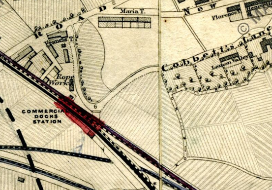
Commercial Docks Station depicted on a map from 1864 (image: mapco.net).
The second; ‘Southwark Park Station’ opened on the same site in 1902 but faced immediate competition from a number of bus and tram routes which were flourishing locally.
Like Spa Road, Southwark Park Station struggled financially and closed its doors permanently in WWI, leaving a few visible remnants at street level.

Bricked up windows of the former Southwark Park Station.
*
Junction Pioneers
The late 1830s saw the founding of The London and Croydon Railway which also operated out of London Bridge, sharing tracks with the London and Greenwich Railway as far as Corbetts Lane.
At Corbetts Lane, the Croydon contingent constructed their own viaduct which branched off southwards from the original arches, thus creating one of the world’s first major railway junctions.
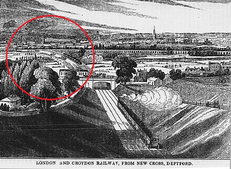
Early depiction of the London and Croydon Railway’s southern branch. The junction at Corbetts Lane is circled in red (image: Wikipedia).
To oversee this new-fangled jumble of tracks, a policeman was stationed in a wooden tower on the viaduct above Corbetts Lane to oversee the movement of trains, essentially making the set up the world’s first signal box.
The early signal man was aided by a large, white disc which would be spun forwards or sideways to indicate the direction at which the points were set.
At night time, red and white lights were used; a novelty which soon led the tower to be nicknamed the ‘Corbetts Lane Lighthouse’.
*
The Den
On the south side of this early junction stands The (New) Den; home to Millwall F.C since 1993.

Satellite image of The Den and railway junction (image: Google).
Replacing the famously intimidating original Den which had been located on nearby Cold Blow Lane, The New Den was the first football venue to be built in London since 1937.
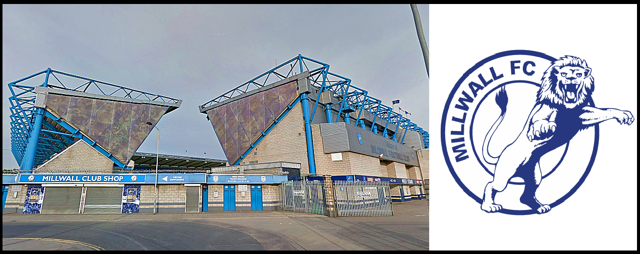
The latest Den, built in the early 1990s (image: Google streetview).
With a capacity of 20,000, The New Den was also Britain’s first all-seater stadium to be built following 1989’s Hillsborough disaster. Consequently, its design was very much geared towards safety and crowd control, incorporating short, quick escape routes.
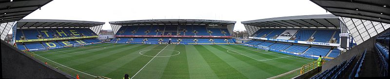
Inside The Den (image: Wikipedia).
Costing £16 million to build, the stadium was opened by the then leader of the Labour Party, John Smith who died suddenly the following year aged just 56.
*
Silwood Street… Tea and Rubbish
Corbetts Lane runs into Silwood Street; a grubby, isolated road which has been plagued with illegal dumping for many years. Although this antisocial blight still goes on to some extent, the area is starting to undergo redevelopment.

Scenes from Silwood Street… the London and Greenwich arches and signs of fly tipping..
When the London and Greenwich Railway opened, the land surrounding this area was very much open countryside.
The area now covered by the Silwood Estate was once home to the ‘St Helena Tavern and Tea Gardens‘ which were established in 1770 and offered a pleasant excursion for over 100 years until being swallowed up in 1881 by London’s rapid sprawl.
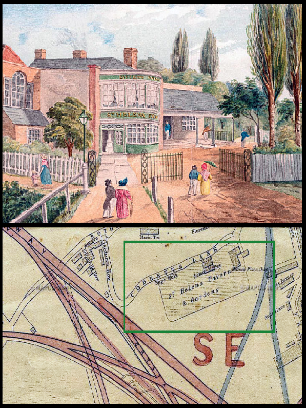
The St Helena Tavern and map indicating its former location.
At the end of Silwood Street, the viaduct crosses over another of the capital’s railway lines- the London Overground (formerly the East London line) where you can get up close and personal with the electrified tracks…
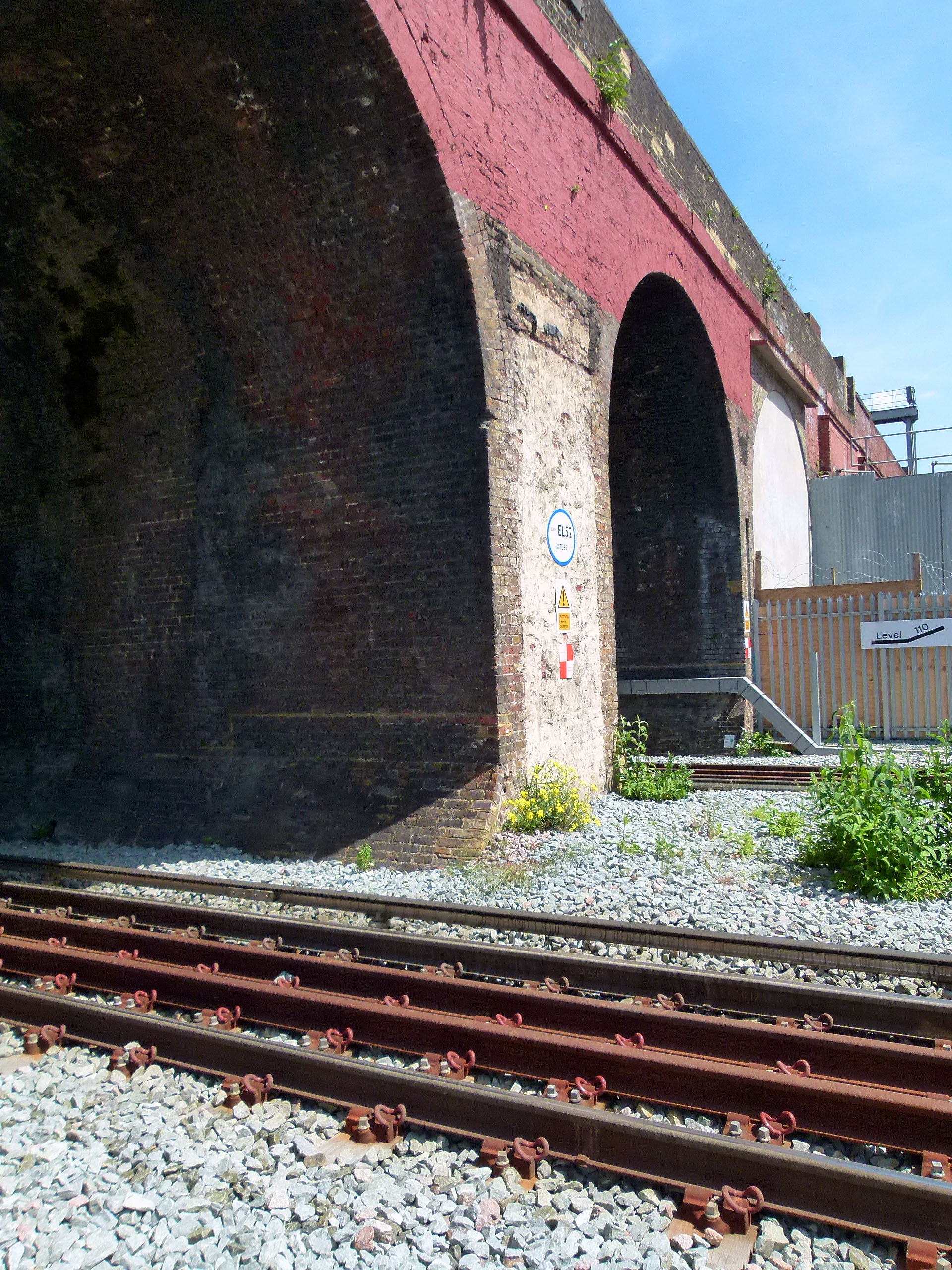
Tracks over tracks… the viaduct crosses the London Overground.
To be concluded.
Secrets of the Viaducts: Walking the London Bridge to Greenwich Arches (Part Three)
* * *

St James’s; Courtesy of Napoleon
A short distance from the now disused Spa Road station stands St James’s Church, Bermondsey which first opened in 1829, predating the London and Greenwich Railway by just seven years.

St James’s Church behind the railway arches as depicted in the 1830s.
Designed by James Savage, St James’s belongs to a group known as the ‘Waterloo Churches’; one of many built across the country with money granted by parliament as a way of celebrating peace following the defeat of Napoleon.
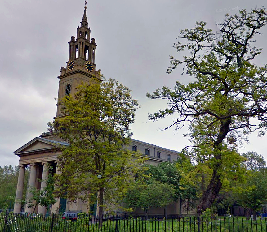
St James’s Bermondsey today (image: Google Streetview).
St James’s is distinctive in that its bells are cast from French cannons seized at the Battle of Waterloo.
When it opened, the church was also blessed with one of the largest pipe organs in the land.
Despite this accolade, the organ was dismantled in the 20th century, its parts stashed away in various nooks of the church for over 50 years. Luckily most of these components survived, enabling the organ to be fully restored in 2002, making it the UK’s most complete example from its era.

St James’s Organ (image: copyright Stephen Craven via Geograph).
Also of note is the spire of St James’s, which is closely based upon the one designed by Sir Christopher Wren for St Stephen’s Walbrook near Mansion House.

Two similar spires… St Stephen’s Walbrook in the City (left) and St James’s Bermondsey (right). Images: Google Streetview.
In the early 1960s there were threats to demolish St James’s church…a travesty which was thankfully avoided primarily due to the intervention of the great poet and champion of historical architecture, Sir John Betjeman.

The interior of St James’s Bermondsey (image: copyright Stephen Craven via Geograph).
*
St James’s Road
St James’s church lends its name to St James’s Road; a long route linking Jamaica Road to the Old Kent Road. St James’s Road is crossed by the railway viaduct towards its northern end.

The viaduct over St James’s Road.
In this vicinity, several of the arches are employed as a depot for Sands Films a small company specializing in costume dramas who recently provided outfits for the big-screen version of Les Miserables.

Film scenery stashed away below the arches.
The arches here also swoop past The St James Tavern; a traditional Bermondsey boozer which is home to Butchie’s of Bermondsey; a seafood stall where, if you’re feeling adventurous, you can purchase a pot of jellied eels for a truly authentic taste of London.
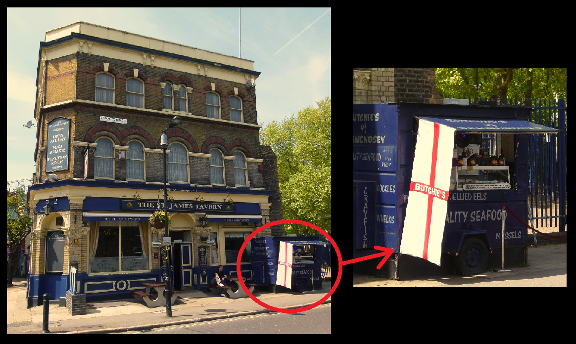
The St James Tavern and Butchie’s of Bermondsey.
Running alongside the pub is Linsey Street, much of which is closed in by the arches and features a bold mural, painted by local youngsters from the Salmon Youth Centre in 2003.

Mural beneath the Linsey Street arches.
On the other side of the viaduct, Linsey Street meets Lucey Road and Lucey Way where a lofty water tower looms over the tracks.

Lucey Road’s water tower.
*
A Crime of Passion
In the early 1890s, a German citizen by the name of Franz Joseph Munch came to live on Lucey Road after fleeing his homeland to avoid military service. Munch found work as a baker on the same street and soon fell in love with his employer, Mrs Bridget Kenrath.
Lucey Way today.
Unfortunately for Munch, there was a rival for Mrs Kenrath’s affections in the form of a fellow baker called James Hickey… as well as coming into conflict over their shared love interest, Hickey also hounded Munch with continual xenophobic slurs.
The spat came to a head one evening in April 1891….
Following yet another bust-up, Hickey apparently informed Munch, “If I have ever done you any harm, you know your remedy.”
Munch did indeed know the ‘remedy’.
Shortly after the row, the German cornered Hickey, pulling a gun on his tormentor and shooting him.
Munch was quickly apprehended by two passing policemen who also took it upon themselves to haul his victim to the Lord Palmerston; a pub which once stood on Lucey Road, where the shot man managed to down a brandy before dying.

The now vanished Lord Palmerston on Lucey Road, pictured during the 1930s. (Image: Pubhistory.com)
Whilst in court, Munch is reported to have “laughed several times and appeared quite unconcerned”, admitting that the murder was the result of a love affair.
Sentenced to death, he appealed on the grounds that he’d been subject to extreme provocation and looked to the German embassy for assistance… but when they discovered Munch had originally fled to London to avoid conscription, they informed their fellow countryman that he was on his own.
Munch was executed at Wandsworth prison on 21st July 1891.
*
Taking the Biscuit
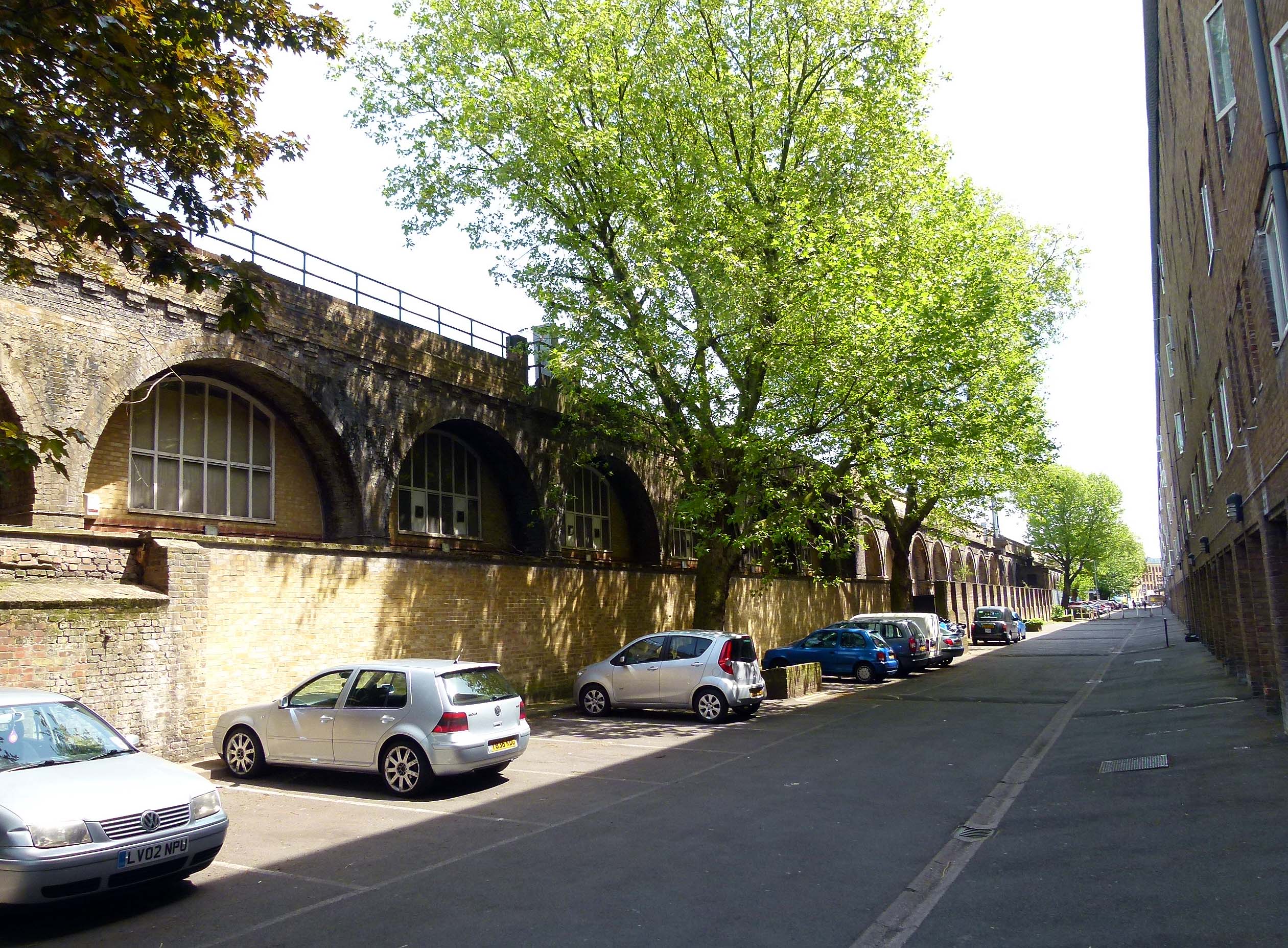
After rattling over Linsey Street and St James’s Road, the railway arches pass through a stretch bordered by Blue Anchor Lane, Bombay Street and Drummond Road.
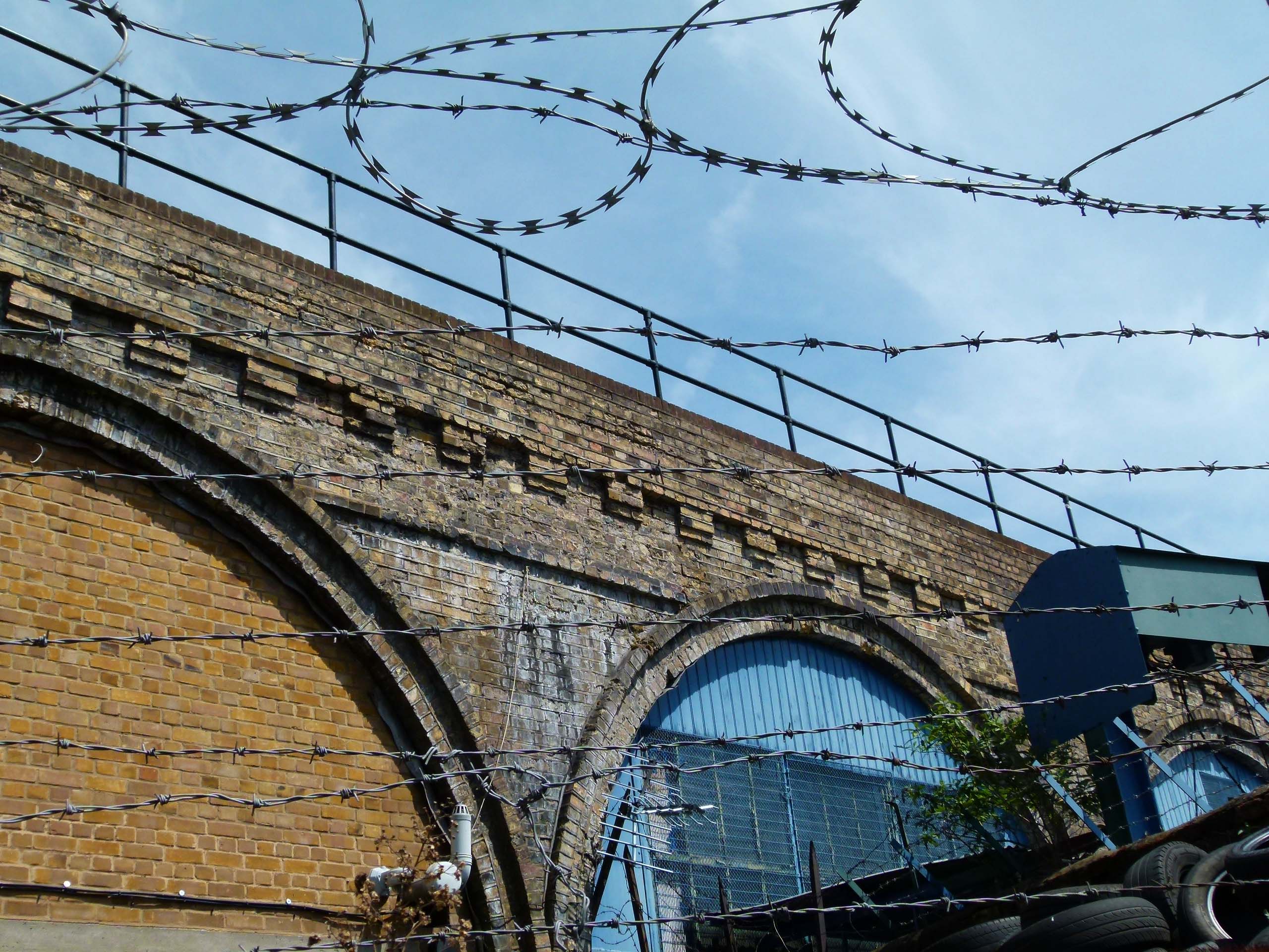
Barbed wire on Bombay Street.
In 1857, James Peek and George Hender Frean established a biscuit factory on Drummond Road; the buildings of which still back onto the arches of the London and Greenwich Railway.
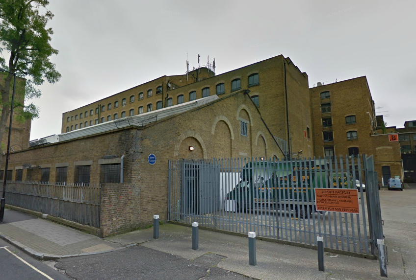
Drummond Road’s former biscuit factory. (Image: Google Streetview).
The crumbly treats baked in Bermondsey by Peek and Frean became immensely popular and were soon being exported to places as far away as India and Australia.

James Peek and George Frean; pioneering biscuit makers. (Image: Freshford.com).
It was in the Drummond Road factory that the Marie (the world’s first chocolate biscuit when introduced in 1875), the Garibaldi, the Bourbon (originally known as the ‘Cream Sandwich’) and many more were invented, the creation of which sent delicious smells wafting over Bermondsey for many decades- a welcome contrast to the stinking tanneries which lurked on the streets closer to London Bridge….
In 1906, ‘A Visit to Peek Frean and Co.’s Biscuit Works’ was filmed by Cricks and Sharp, essentially making the factory the subject of one of the world’s earliest documentary films.
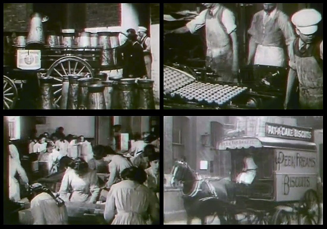
Screenshots from ‘A Visit to Peek Frean & Co.’s Biscuit Works’, 1906.
Peek Frean grew to become one of Bermondsey’s largest employers and by the 1940s some 4,000 people worked at the factory. Staff were well looked after, with free in-house dental and eye care and plenty of social clubs to keep them entertained.

A colourful selection of adverts from Peek Frean’s heyday.
In the late 1920s, the company branched into the cocktail snack market, developing the savoury Twiglets. The nibbles were developed by Monsieur Rondalin; a Frenchman who was employed at the factory as a technical manager.

Sadly, Peek Frean’s Bermondsey plant ceased production in 1989. The buildings remain however, and have since been converted into The Biscuit Factory; a complex of studios and office space.
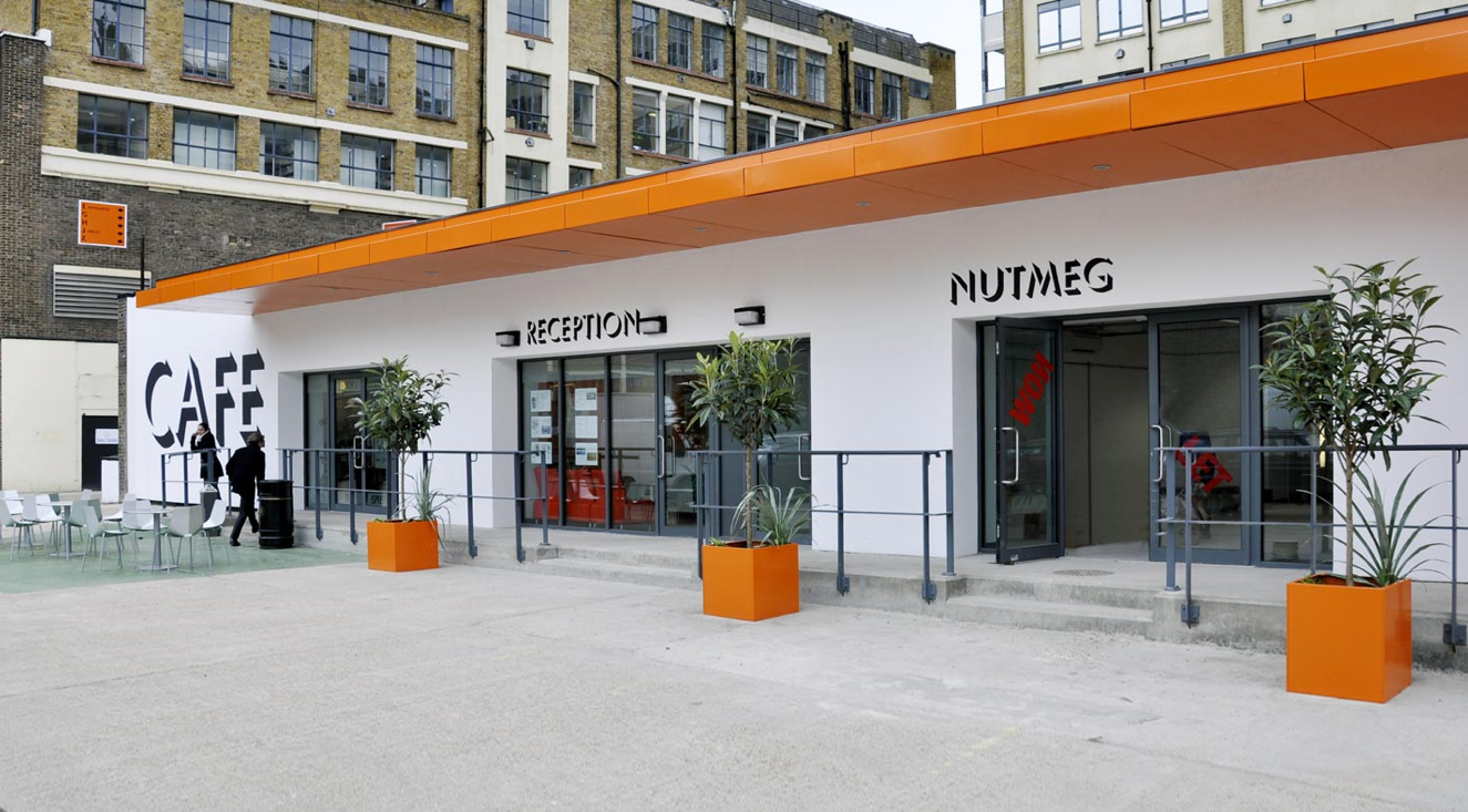
Peek Frean’s updated premises today (image: The Biscuit Factory).
Despite the closure of the London site, Peak Frean continue to churn out biscuits- the company now operate a large factory in the East York area of Toronto, Canada… the address of which is Bermondsey Road!

Peek Frean’s Canadian premises on Bermondsey Road, Toronto. (Image: Google Streetview).
*
Blue Anchor Lane
On January 21st 1947, a steam train collided with an electric train in heavy fog on the viaduct above Blue Anchor Lane. Although the wreckage looked pretty nasty, there was luckily just one minor injury.

The 1947 collision above Blue Anchor Lane (image: London Illustrated News).
Years before, in August 1872, a horrific murder took place on Blue Anchor Lane when a notorious local drunkard and barber named James Daniel Rogers slashed his wife’s throat after returning from a family day out to Hackney’s Victoria Park.

The arches pass Blue Anchor Lane.
Although the chief surgeon at Newgate gaol stated that Rogers was “perfectly sane”, the jury thought otherwise and found the defendant “not guilty, on the ground of insanity”… a verdict which saw the barber incarcerated nonetheless.

Blue Anchor Lane today (image: Google Streetview).
This wasn’t the first time such a violent deed had been committed on Blue Anchor Lane.
In 1802, it was reported that a Mr Spencer was “passing Blue Anchor Lane, Bermondsey” when he was:
“Stopped by three footpads, who knocked him down and robbed him of his pocket book, which the villains were not content with…they dragged him into a field, stripped him naked except his breeches, and then beat him with bludgeons in the most inhuman manner; they then threw him into a ditch where they left him for dead. He was discovered some time after by his groans…”

Blue Anchor Lane in the days when it was surrounded by countryside…
*
Yes we ‘Can’…
Named after a local pub (which still stands), Blue Anchor Lane is an offshoot of the much longer Southwark Park Road- which itself was once known as Blue Anchor Road.
It was on Blue Anchor Road that the process of canning food was pioneered by the engineer, Bryan Donkin.

Bryan Donkin… canned food pioneer.
Born in Northumberland, Bryan Donkin came to Bermondsey in 1802 where he established a factory on Blue Anchor Road (on what were then open fields), the purpose of which was to produce machines for manufacturing paper.
By 1812, Donkin felt confident enough to branch out into other ventures and began to experiment with preserving food in sealed, iron containers.

An early Donkin can. (Image: Science Museum via the BBC).
His trials were a success- the preserved food even receiving a written endorsement from King George III- and by 1818, Donkin’s Bermondsey cannery was supplying the Royal Navy with over 20,000 cans of meat, soup and tinned vegetables per year; a deal which revolutionized the military after years of hard biscuits, salted meat and malnutrition.
*
Being in its infancy, the process of canning was done by hand; the tins specially crafted with a hole left in the top, into which the food was poured.
The hole was then covered with a metal disc- soldered on to provide the seal- and the tin then heated for an hour in boiling water. If the can wasn’t heated for long enough however, some bacteria could survive, turning the contents into a putrid, stinking mess which no doubt offended the nose of many an early consumer.
Another risk came from the lead used for soldering which would slowly leak into the food over time.
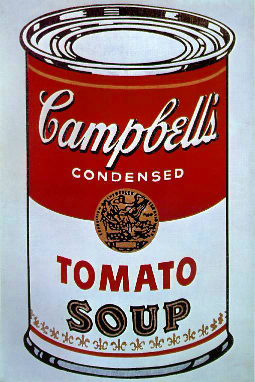
Andy Warhol’s famous 1962 ‘Campbell’s Soup Can’… which, in a roundabout way, may not have existed if it were not for Bryan Donkin’s Bermondsey plant!
It would take many years before someone had the bright idea of inventing the can opener- in the early days, the containers had to be cracked open with a hammer and chisel or, if you were feeling brave, by attacking the tin with a sharp knife.

Opening instructions from a tin sold by Fortnum & Mason (image: BBC).
Donkin’s cannery was later merged into the Crosse and Blackwall empire and the site of the pioneering factory is now occupied by The Harris Academy school.

The Harris Academy, site of the pioneering cannery. (Image: Google Streeview).
*