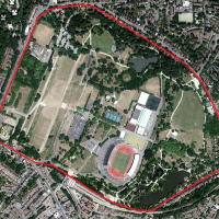
Candid Capital: Dizzy Heights Hotel
Dizzy Heights Hotel

The recently opened ‘M by Montcalm’ hotel, City Road
Candid Capital: The Trellick Tower
The Trellick Tower
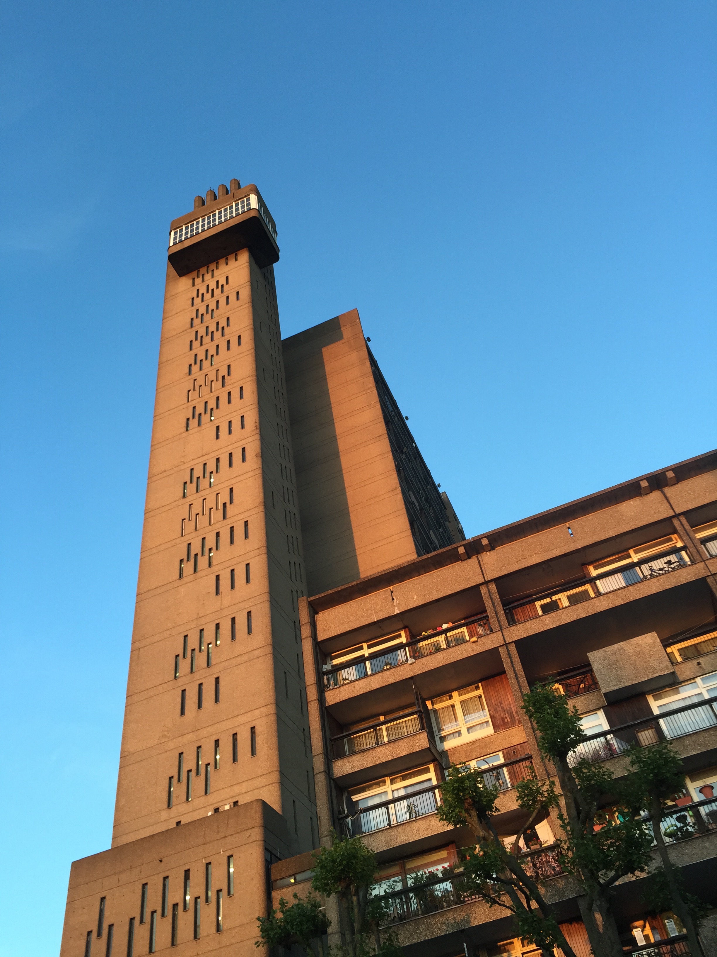
This iconic building has loomed over West London for over forty years. Please click here to read an earlier post in which I detail the tower’s history.
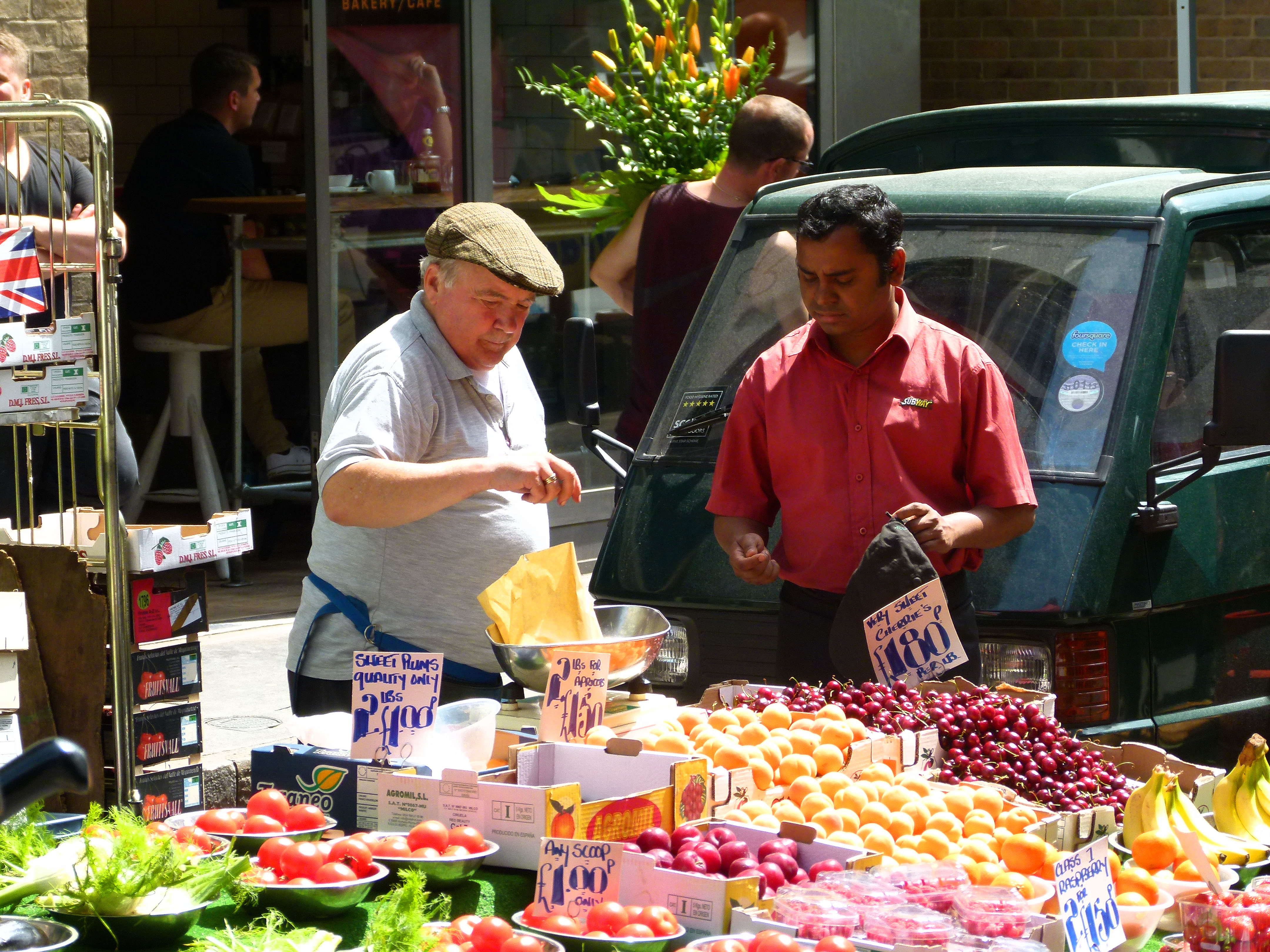
Cabbie’s Curios: The Markets That Never Were…
Ever since Roman times, markets have been an integral part of London’s fabric. Many have come, lots have gone, some have switched location altogether whilst others have evolved and reinvented themselves as lively tourist destinations.
Beriwck Street Market in Soho.
*
Back in 1893, the London County Council’s Public Control Department commissioned a report into the capital’s 138 markets examining their size, income, impact on the local area and so on.
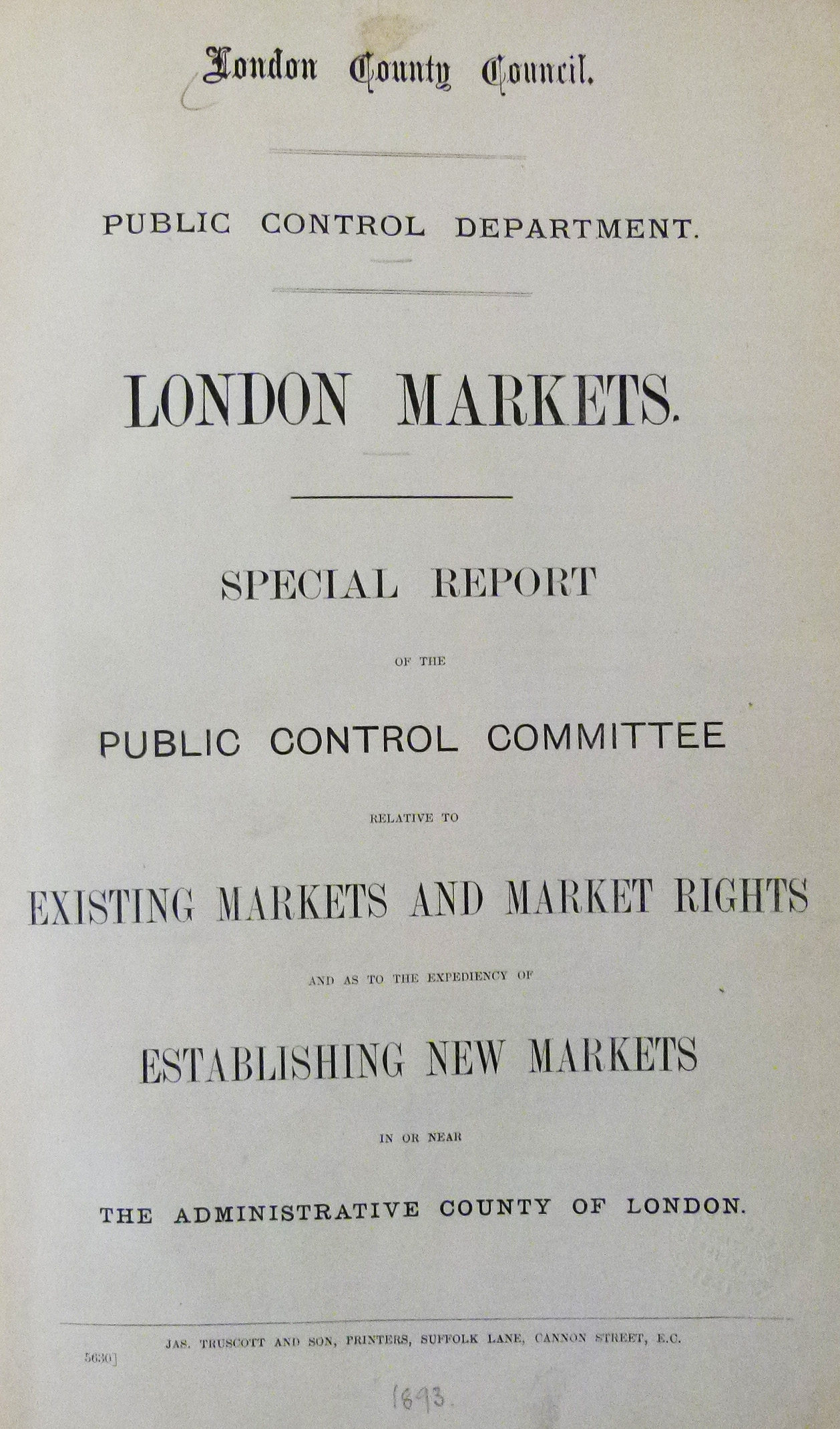
Intriguingly, the report singled out three markets in particular- all of which lay in what were then impoverished areas- suggesting that they should be drastically expanded with large, purpose built premises containing both stall space and other amenities for the benefit of the public.
The document contained sketches of these proposals… none of which were ever put into practice.
Had the schemes been embraced, the districts in which they stood would have been greatly altered and would no doubt appear very different today.
Here is a brief glimpse, therefore of a London that never was…
Leather Lane Market
Leather Lane runs parallel to Hatton Garden; London’s famous jewellery quarter.
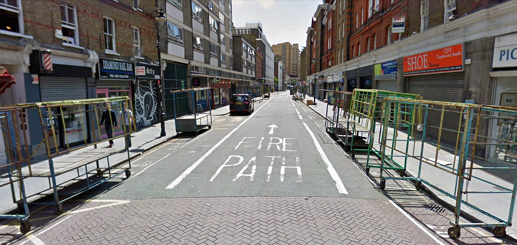
A quiet Leather Lane today (image: Google Streetview).
Although leather goods were indeed sold here, it is believed that the name derives from ‘leveroune’; the French term for greyhound and probably the name of a once local tavern. (Nowadays, the word is spelt ‘levrier’).
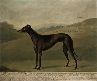
An 18th century Greyhound (image: Christies).
According to the 1893 report, the market held on Leather Lane has “existed from time immemorial” and that the area was “a poor and densely populated district” inhabited by residents who are “chiefly of the labouring class.”

“The eviction of poor Irish families” from Leather Lane, Illustrated London News, January 1892.
The report also described Leather Lane market as being severely overcrowded; “serious inconvenience is caused to the vehicular and general traffic, which on Saturday becomes entirely blocked… At midday in the fruit season the market is densely packed with work-people, lads and girls.”
In order to eradicate this congestion and also to “improve the dwellings of the poor”, the report suggested that a huge, purpose built hall be constructed to accommodate the market.

Floor plan of the proposed Leather Market.
Had it materialized, the market hall would have been circular with ample space for stalls, washing facilities and even a playground on the roof!

The proposed building for Leather Lane.
At the centre of the market there would have been a bandstand, below which would have been a “coffee tavern.”

Where the market would have stood…
Although this grand version never made it off the page, Leather Lane Market survives to this day, albeit on a far smaller scale than its Victorian heyday.
*
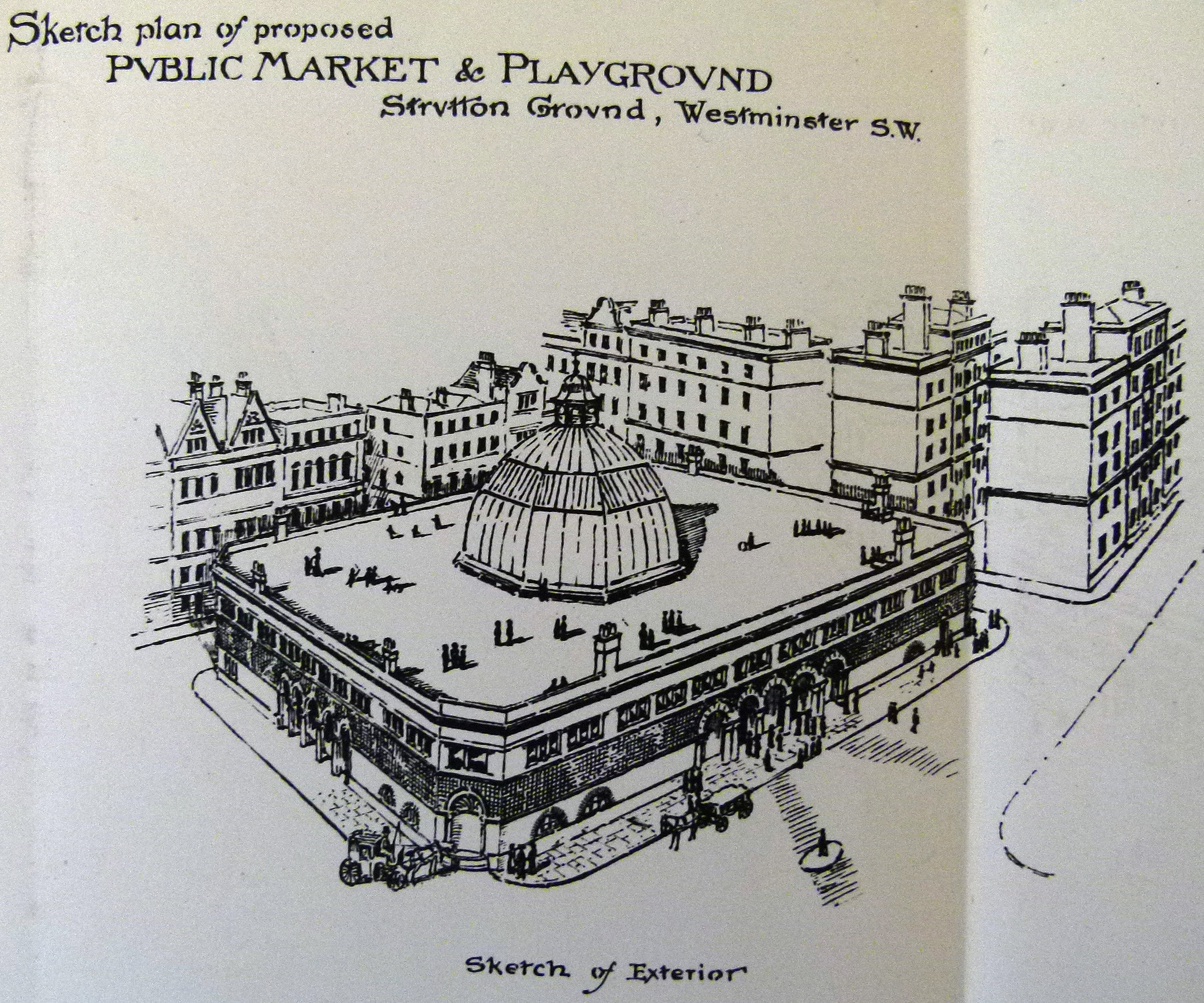
Strutton Ground Market
Established in the 1860s and located moments away from Westminster Abbey, Strutton Ground Market runs along a narrow lane linking Victoria Street to Horseferry Road.

Strutton Ground (image: Google Streetview).
The name derives from ‘Stourton House’; a mansion once based in the area which belonged to the Lord Dacre of the South.
The County Council’s report stated that Strutton Ground was part of “an old district, very thickly populated, the residents, exclusive of the shop-keepers, consisting chiefly of artizans, labourers and the poorer class.”
As with the proposals for Leather Lane, the report envisioned a large market hall with a bandstand, coffee shop and roof-top playground. The exterior was a rather different design though; a bold, rectangular block:
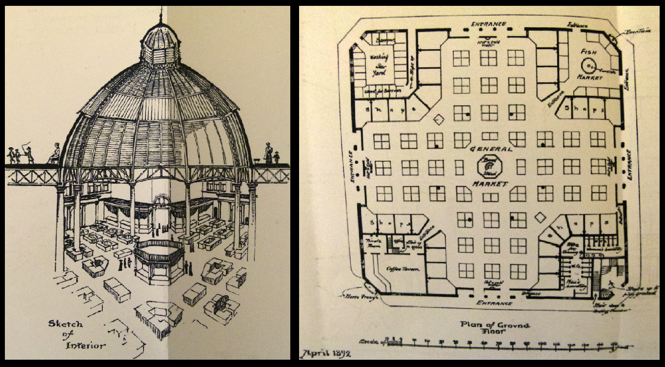
The proposed dome and floor plan for Strutton Ground market.
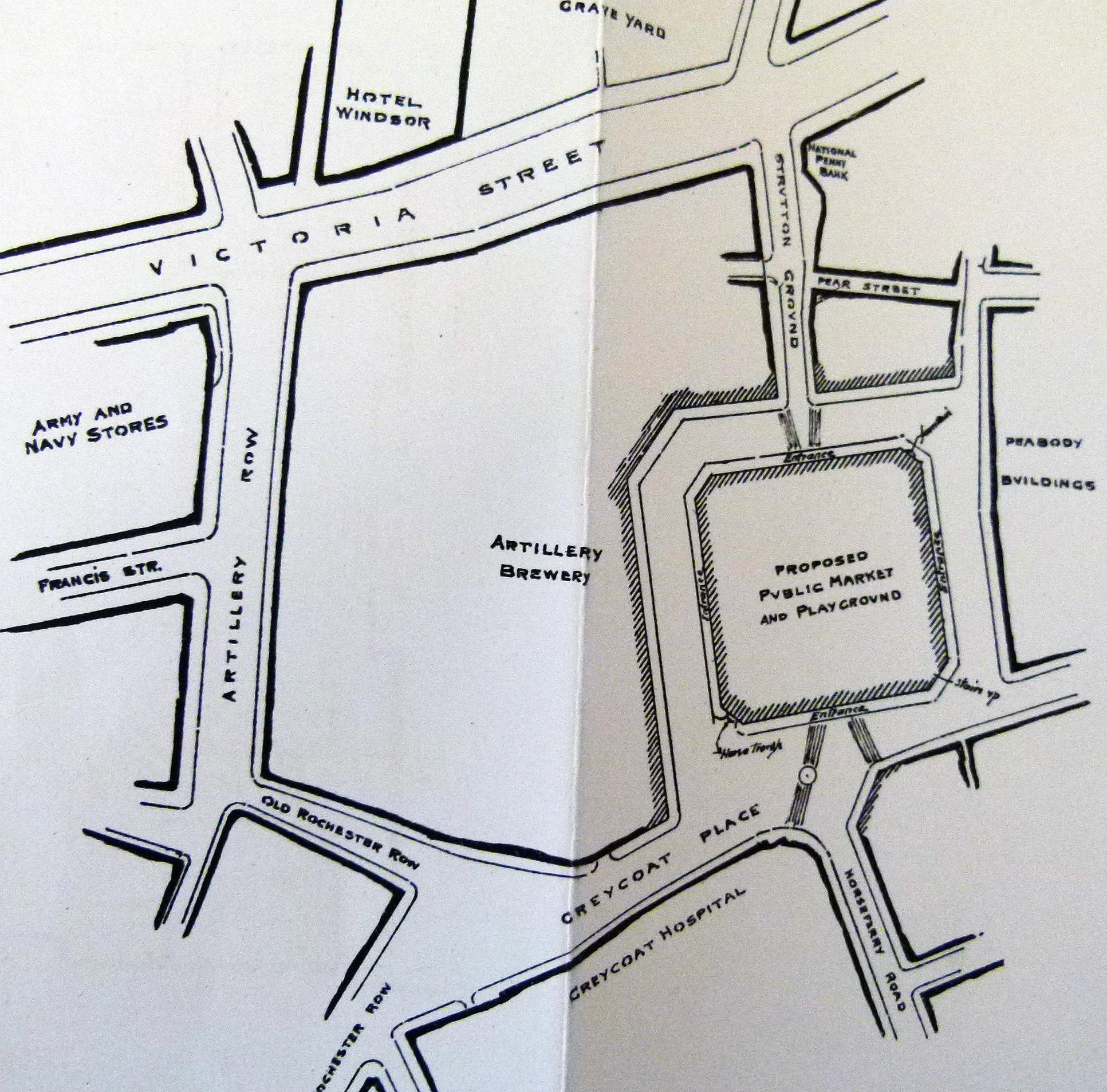
Where the market would have stood if built.
As with Leather Lane, these plans were never used. The market on Strutton Ground continued without development and still operates today. It is especially popular with workers from the many nearby offices.

Strutton Ground market today (Image: Geograph).
Clare Market
Clare Market began operating in the 17th century and took its name from the Earl of Clare, John Holles who owned the land.
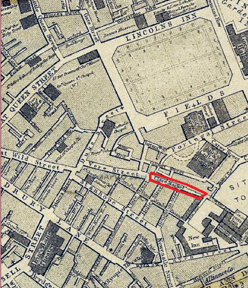
Location of the former Clare Market.
The 1890s report described the area served by Clare Market as being “very densely populated… chiefly occupied by the poorest class of people who are crowded into courts, alleys and lodging houses.”
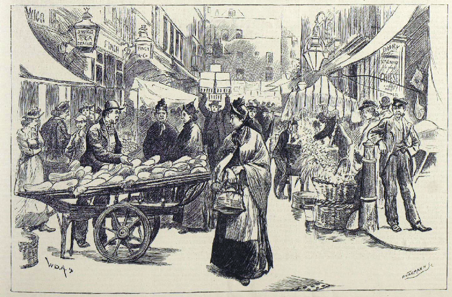
Clare Market, The Illustrated London News, September 1891.
With trade at Clare Market in steep decline, the report’s proposal was not as grand as those dedicated to Leather Lane and Strutton Ground, simply consisting of a basic floor plan.
However, like the other two proposals, running water, a bandstand, coffee tavern and overhead playground were all key components which it was hoped would go some way to alleviating poverty in the area if implemented.
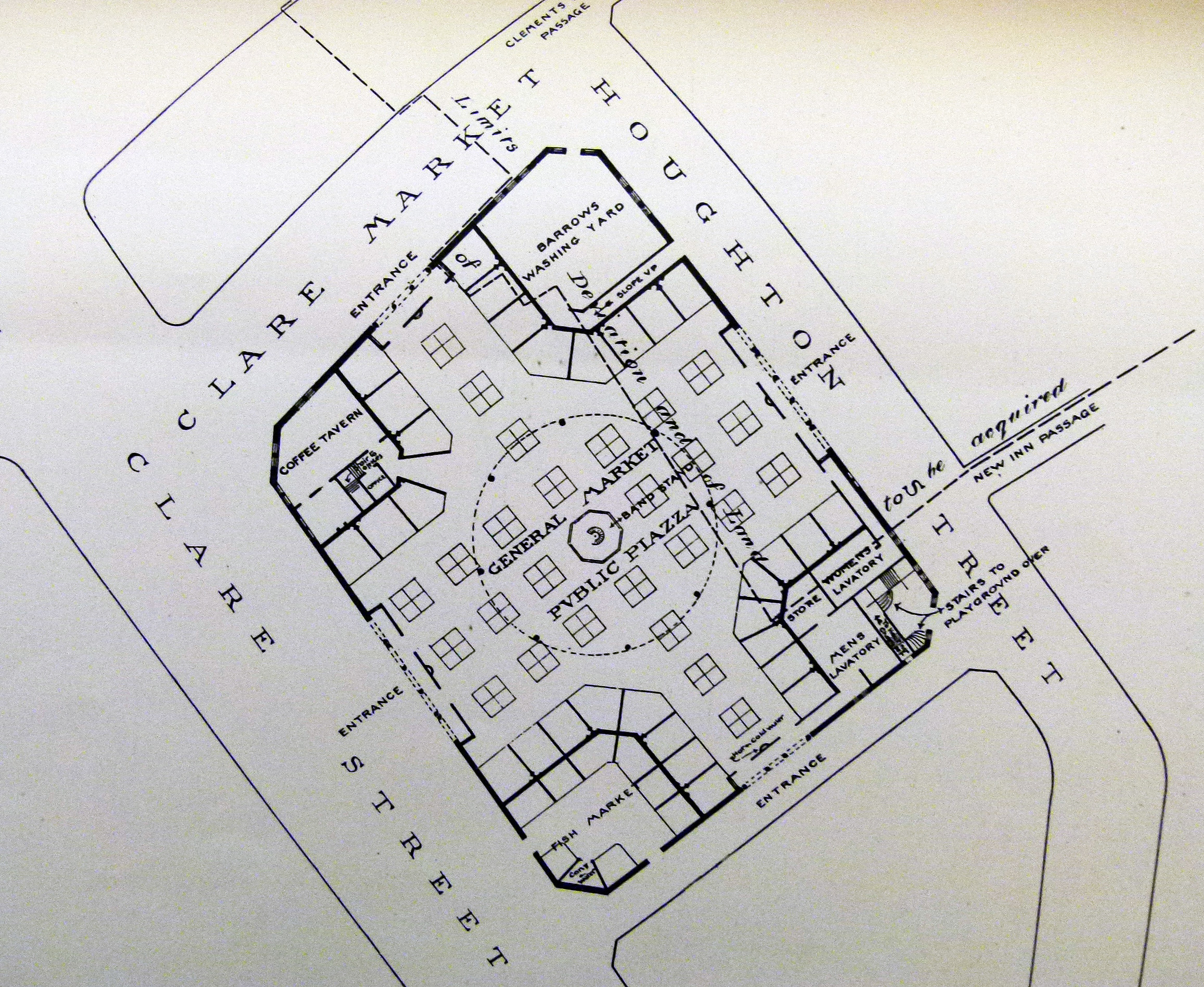
The 1890s proposed floor plan for Clare Market.
Although the report stated that “the Strand Board of Works is of opinion that the market should be allowed to remain”, Clare Market and its surrounding slums were swept away just seven years later, replaced by the grandiose Kingsway and Aldwych development.

Construction of the Kingsway scheme, 1905 (image from ‘Woman and her Sphere’ site).
Today, the spot is now home to the London School of Economics, thus linking Clare Market to financial markets rather than those of the costermonger.

The street known as Clare Market today, now occupied by the London School of Economics (image: Google Streetview).