Secrets of the Viaducts: Walking the London Bridge to Greenwich Arches (Part Three)

* * *

St James’s; Courtesy of Napoleon
A short distance from the now disused Spa Road station stands St James’s Church, Bermondsey which first opened in 1829, predating the London and Greenwich Railway by just seven years.

St James’s Church behind the railway arches as depicted in the 1830s.
Designed by James Savage, St James’s belongs to a group known as the ‘Waterloo Churches’; one of many built across the country with money granted by parliament as a way of celebrating peace following the defeat of Napoleon.
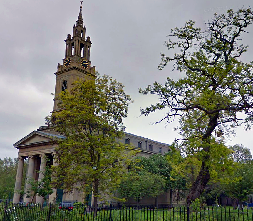
St James’s Bermondsey today (image: Google Streetview).
St James’s is distinctive in that its bells are cast from French cannons seized at the Battle of Waterloo.
When it opened, the church was also blessed with one of the largest pipe organs in the land.
Despite this accolade, the organ was dismantled in the 20th century, its parts stashed away in various nooks of the church for over 50 years. Luckily most of these components survived, enabling the organ to be fully restored in 2002, making it the UK’s most complete example from its era.

St James’s Organ (image: copyright Stephen Craven via Geograph).
Also of note is the spire of St James’s, which is closely based upon the one designed by Sir Christopher Wren for St Stephen’s Walbrook near Mansion House.

Two similar spires… St Stephen’s Walbrook in the City (left) and St James’s Bermondsey (right). Images: Google Streetview.
In the early 1960s there were threats to demolish St James’s church…a travesty which was thankfully avoided primarily due to the intervention of the great poet and champion of historical architecture, Sir John Betjeman.

The interior of St James’s Bermondsey (image: copyright Stephen Craven via Geograph).
*
St James’s Road
St James’s church lends its name to St James’s Road; a long route linking Jamaica Road to the Old Kent Road. St James’s Road is crossed by the railway viaduct towards its northern end.

The viaduct over St James’s Road.
In this vicinity, several of the arches are employed as a depot for Sands Films a small company specializing in costume dramas who recently provided outfits for the big-screen version of Les Miserables.

Film scenery stashed away below the arches.
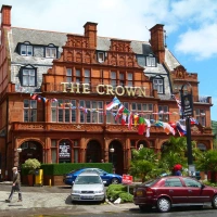
The arches here also swoop past The St James Tavern; a traditional Bermondsey boozer which is home to Butchie’s of Bermondsey; a seafood stall where, if you’re feeling adventurous, you can purchase a pot of jellied eels for a truly authentic taste of London.
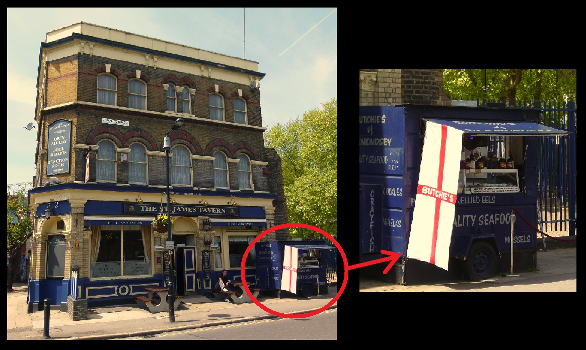
The St James Tavern and Butchie’s of Bermondsey.
Running alongside the pub is Linsey Street, much of which is closed in by the arches and features a bold mural, painted by local youngsters from the Salmon Youth Centre in 2003.

Mural beneath the Linsey Street arches.
On the other side of the viaduct, Linsey Street meets Lucey Road and Lucey Way where a lofty water tower looms over the tracks.

Lucey Road’s water tower.
*
A Crime of Passion
In the early 1890s, a German citizen by the name of Franz Joseph Munch came to live on Lucey Road after fleeing his homeland to avoid military service. Munch found work as a baker on the same street and soon fell in love with his employer, Mrs Bridget Kenrath.
Lucey Way today.
Unfortunately for Munch, there was a rival for Mrs Kenrath’s affections in the form of a fellow baker called James Hickey… as well as coming into conflict over their shared love interest, Hickey also hounded Munch with continual xenophobic slurs.
The spat came to a head one evening in April 1891….
Following yet another bust-up, Hickey apparently informed Munch, “If I have ever done you any harm, you know your remedy.”
Munch did indeed know the ‘remedy’.
Shortly after the row, the German cornered Hickey, pulling a gun on his tormentor and shooting him.
Munch was quickly apprehended by two passing policemen who also took it upon themselves to haul his victim to the Lord Palmerston; a pub which once stood on Lucey Road, where the shot man managed to down a brandy before dying.

The now vanished Lord Palmerston on Lucey Road, pictured during the 1930s. (Image: Pubhistory.com)
Whilst in court, Munch is reported to have “laughed several times and appeared quite unconcerned”, admitting that the murder was the result of a love affair.
Sentenced to death, he appealed on the grounds that he’d been subject to extreme provocation and looked to the German embassy for assistance… but when they discovered Munch had originally fled to London to avoid conscription, they informed their fellow countryman that he was on his own.
Munch was executed at Wandsworth prison on 21st July 1891.
*
Taking the Biscuit
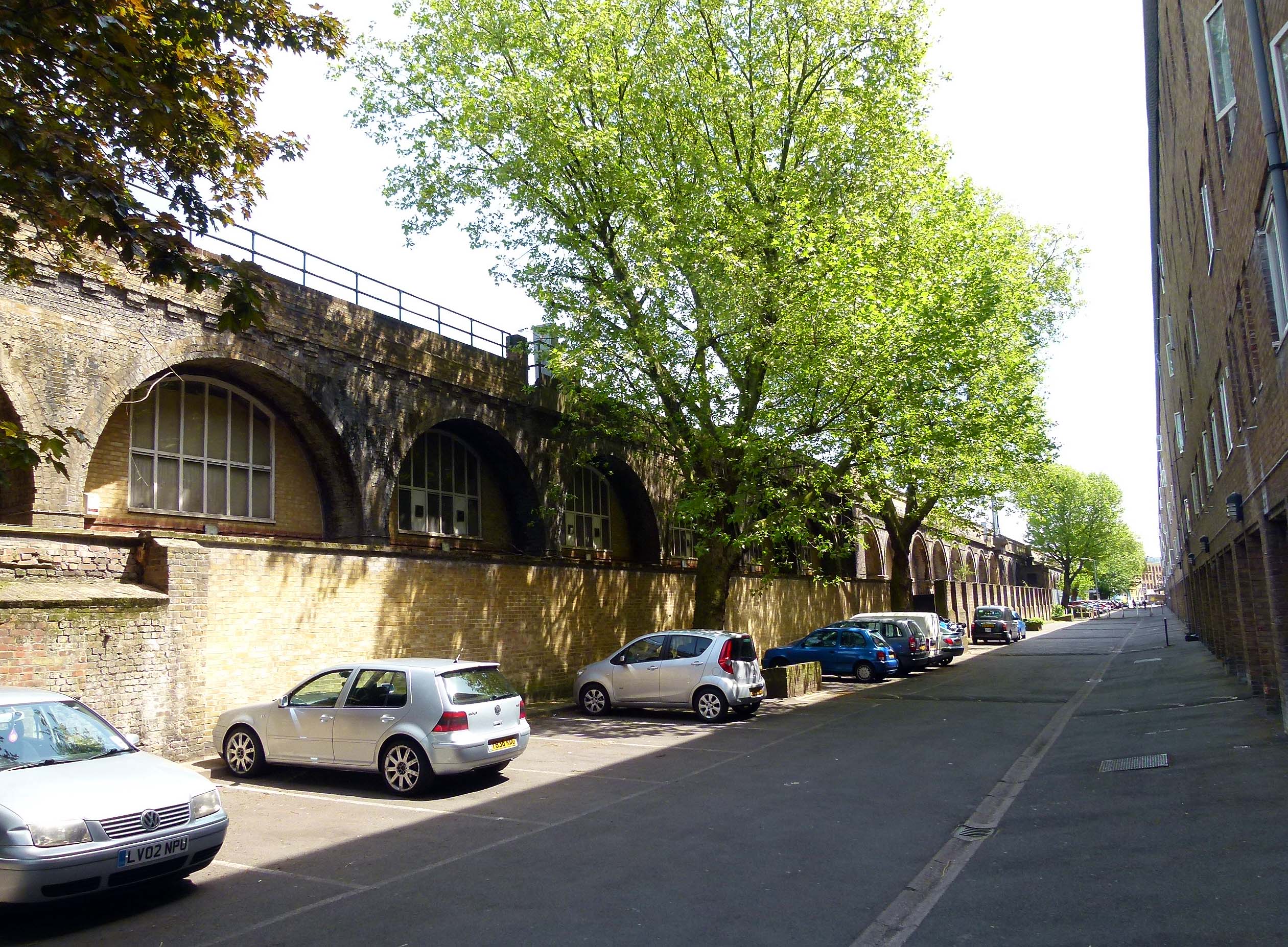
After rattling over Linsey Street and St James’s Road, the railway arches pass through a stretch bordered by Blue Anchor Lane, Bombay Street and Drummond Road.
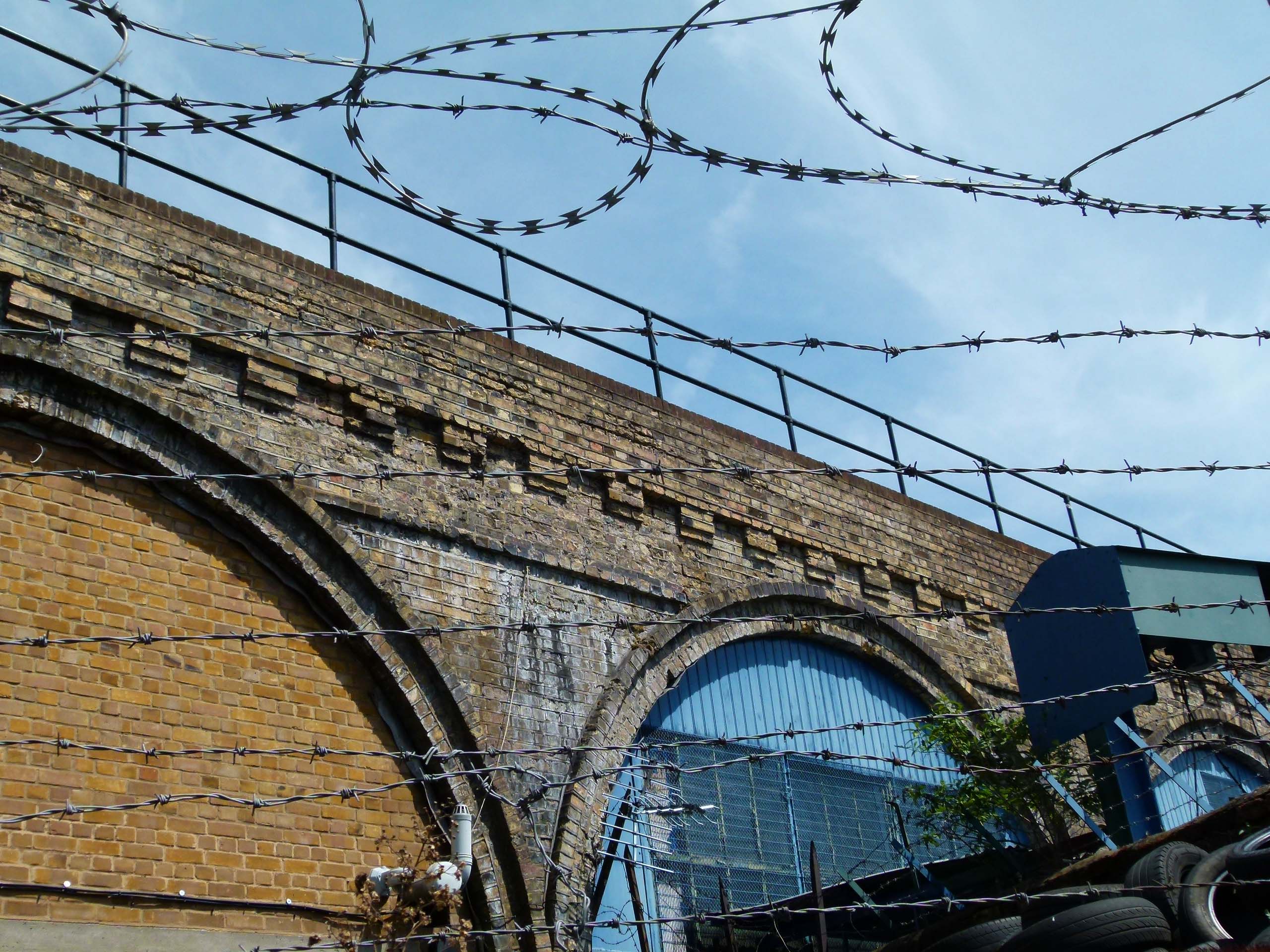
Barbed wire on Bombay Street.
In 1857, James Peek and George Hender Frean established a biscuit factory on Drummond Road; the buildings of which still back onto the arches of the London and Greenwich Railway.
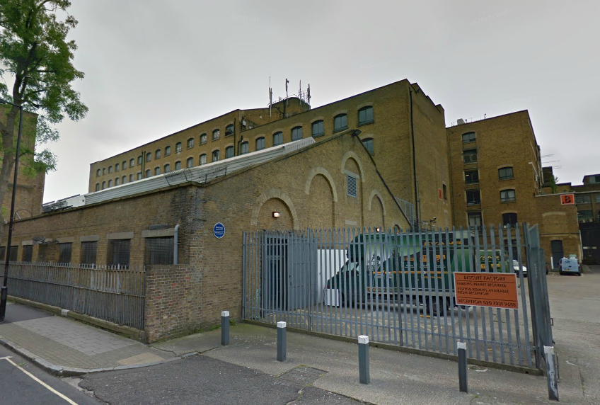
Drummond Road’s former biscuit factory. (Image: Google Streetview).
The crumbly treats baked in Bermondsey by Peek and Frean became immensely popular and were soon being exported to places as far away as India and Australia.

James Peek and George Frean; pioneering biscuit makers. (Image: Freshford.com).
It was in the Drummond Road factory that the Marie (the world’s first chocolate biscuit when introduced in 1875), the Garibaldi, the Bourbon (originally known as the ‘Cream Sandwich’) and many more were invented, the creation of which sent delicious smells wafting over Bermondsey for many decades- a welcome contrast to the stinking tanneries which lurked on the streets closer to London Bridge….
In 1906, ‘A Visit to Peek Frean and Co.’s Biscuit Works’ was filmed by Cricks and Sharp, essentially making the factory the subject of one of the world’s earliest documentary films.
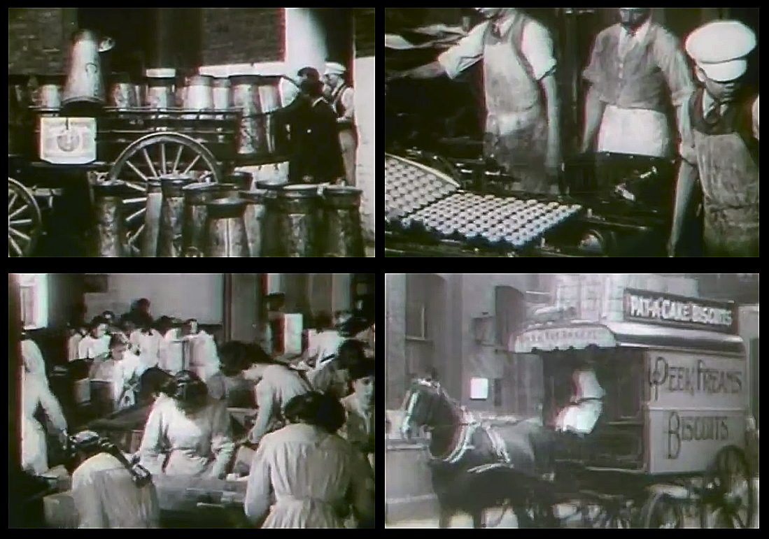
Screenshots from ‘A Visit to Peek Frean & Co.’s Biscuit Works’, 1906.
Peek Frean grew to become one of Bermondsey’s largest employers and by the 1940s some 4,000 people worked at the factory. Staff were well looked after, with free in-house dental and eye care and plenty of social clubs to keep them entertained.

A colourful selection of adverts from Peek Frean’s heyday.
In the late 1920s, the company branched into the cocktail snack market, developing the savoury Twiglets. The nibbles were developed by Monsieur Rondalin; a Frenchman who was employed at the factory as a technical manager.

Sadly, Peek Frean’s Bermondsey plant ceased production in 1989. The buildings remain however, and have since been converted into The Biscuit Factory; a complex of studios and office space.
Peek Frean’s updated premises today (image: The Biscuit Factory).
Despite the closure of the London site, Peak Frean continue to churn out biscuits- the company now operate a large factory in the East York area of Toronto, Canada… the address of which is Bermondsey Road!

Peek Frean’s Canadian premises on Bermondsey Road, Toronto. (Image: Google Streetview).
*
Blue Anchor Lane
On January 21st 1947, a steam train collided with an electric train in heavy fog on the viaduct above Blue Anchor Lane. Although the wreckage looked pretty nasty, there was luckily just one minor injury.

The 1947 collision above Blue Anchor Lane (image: London Illustrated News).
Years before, in August 1872, a horrific murder took place on Blue Anchor Lane when a notorious local drunkard and barber named James Daniel Rogers slashed his wife’s throat after returning from a family day out to Hackney’s Victoria Park.

The arches pass Blue Anchor Lane.
Although the chief surgeon at Newgate gaol stated that Rogers was “perfectly sane”, the jury thought otherwise and found the defendant “not guilty, on the ground of insanity”… a verdict which saw the barber incarcerated nonetheless.

Blue Anchor Lane today (image: Google Streetview).
This wasn’t the first time such a violent deed had been committed on Blue Anchor Lane.
In 1802, it was reported that a Mr Spencer was “passing Blue Anchor Lane, Bermondsey” when he was:
“Stopped by three footpads, who knocked him down and robbed him of his pocket book, which the villains were not content with…they dragged him into a field, stripped him naked except his breeches, and then beat him with bludgeons in the most inhuman manner; they then threw him into a ditch where they left him for dead. He was discovered some time after by his groans…”

Blue Anchor Lane in the days when it was surrounded by countryside…
*
Yes we ‘Can’…
Named after a local pub (which still stands), Blue Anchor Lane is an offshoot of the much longer Southwark Park Road- which itself was once known as Blue Anchor Road.
It was on Blue Anchor Road that the process of canning food was pioneered by the engineer, Bryan Donkin.

Bryan Donkin… canned food pioneer.
Born in Northumberland, Bryan Donkin came to Bermondsey in 1802 where he established a factory on Blue Anchor Road (on what were then open fields), the purpose of which was to produce machines for manufacturing paper.
By 1812, Donkin felt confident enough to branch out into other ventures and began to experiment with preserving food in sealed, iron containers.

An early Donkin can. (Image: Science Museum via the BBC).
His trials were a success- the preserved food even receiving a written endorsement from King George III- and by 1818, Donkin’s Bermondsey cannery was supplying the Royal Navy with over 20,000 cans of meat, soup and tinned vegetables per year; a deal which revolutionized the military after years of hard biscuits, salted meat and malnutrition.
*
Being in its infancy, the process of canning was done by hand; the tins specially crafted with a hole left in the top, into which the food was poured.
The hole was then covered with a metal disc- soldered on to provide the seal- and the tin then heated for an hour in boiling water. If the can wasn’t heated for long enough however, some bacteria could survive, turning the contents into a putrid, stinking mess which no doubt offended the nose of many an early consumer.
Another risk came from the lead used for soldering which would slowly leak into the food over time.
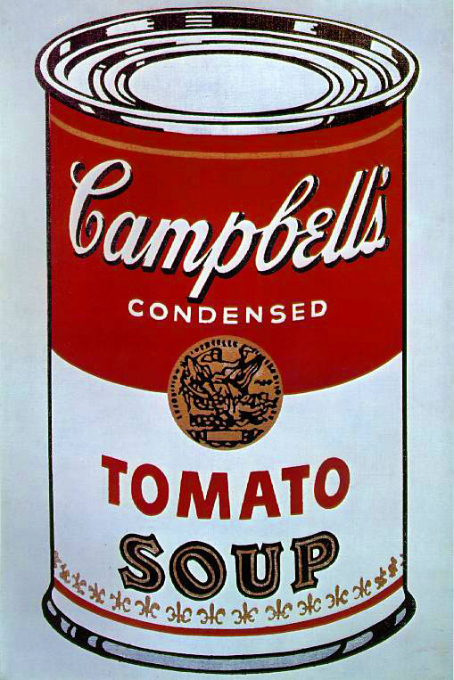
Andy Warhol’s famous 1962 ‘Campbell’s Soup Can’… which, in a roundabout way, may not have existed if it were not for Bryan Donkin’s Bermondsey plant!
It would take many years before someone had the bright idea of inventing the can opener- in the early days, the containers had to be cracked open with a hammer and chisel or, if you were feeling brave, by attacking the tin with a sharp knife.

Opening instructions from a tin sold by Fortnum & Mason (image: BBC).
Donkin’s cannery was later merged into the Crosse and Blackwall empire and the site of the pioneering factory is now occupied by The Harris Academy school.

The Harris Academy, site of the pioneering cannery. (Image: Google Streeview).
*
To be continued
Secrets of the Viaducts: Walking the London Bridge to Greenwich Arches (Part Two)
This is part two in a series examining the history on and around the arches of the London and Greenwich Railway which was constructed in the 1830s.
To read part one, please click here.
* * *
London Bridge
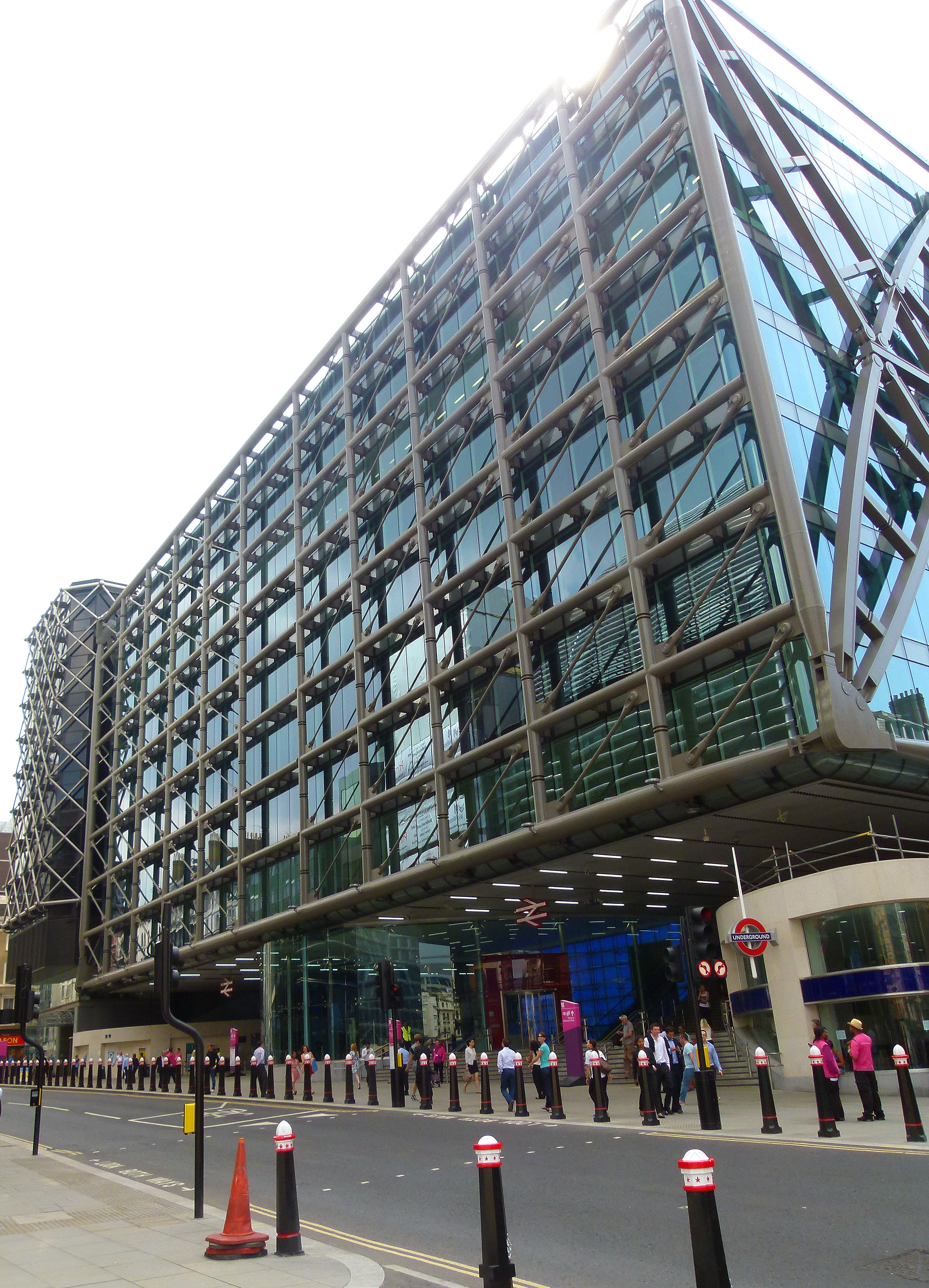
The viaduct to Greenwich begins its journey from London Bridge station; a terminal which is currently undergoing a major revamp beneath the shadow of The Shard– Western Europe’s tallest building.

Looking up at The Shard from London Bridge Station.
Since Roman times there have been many different versions of London Bridge, all of which have stood on the same spot, give or take a few feet. To read a previous post on the history of London Bridge, please click here.
When the London and Greenwich Railway opened in 1836, the bridge after which its terminal was named would have been the version built by John Rennie and, having been completed in 1831, would have been pretty much brand new at the time.

John Rennie’s London Bridge, seen from the direction of London Bridge Station. (Image: Victorian web)
Rennie’s bridge was replaced by today’s more utilitarian version in 1971… the original having been relocated to Lake Havasu in Arizona, USA after being purchased as the world’s largest antique by oil tycoon, Robert P. McCulloch.
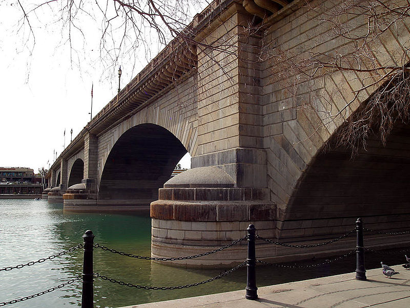
John Rennie’s London Bridge as it now stands in Arizona… (image: Wikipedia).
Stainer Street
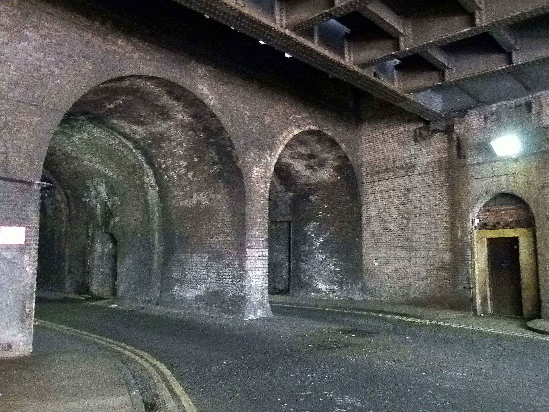
Dank with atmosphere, Stainer Street runs through a long tunnel beneath London Bridge Station.

Driving through Stainer Street… (image: Google Streetview).
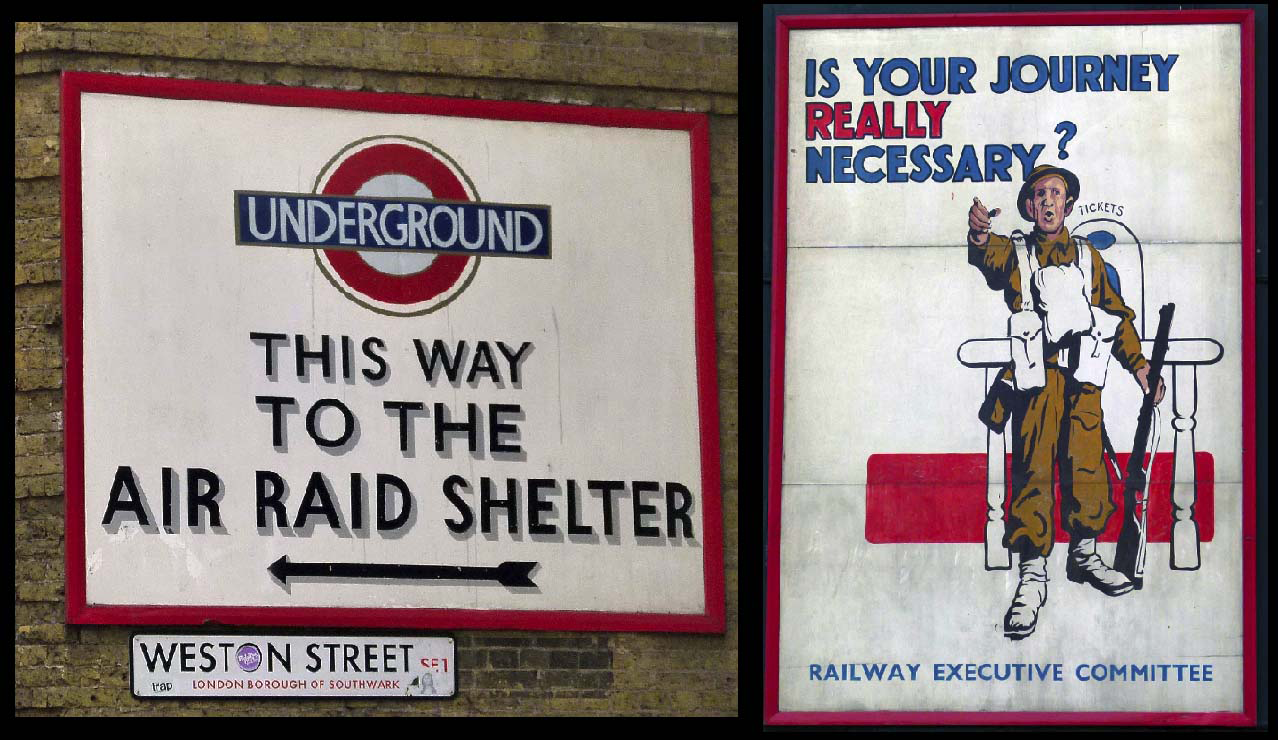
During WWII, this cavernous area was employed as an air raid shelter for Londoners seeking protection during the nightly Blitz.
Tragically, on the evening of the 17th February 1941, catastrophe came to Stainer Street when the long arch suffered a direct hit, killing 68 people and injuring a further 178. Many of the casualties were medical staff from nearby Guys Hospital, who had rushed to the scene to help- only to be struck by a second explosion.

Aftermath of the Stainer Street bombing, 1941.
A large number of the fatalities were inflicted by the shelter’s steel blast doors which, weighing 10 tonnes a piece, had been installed at both ends of the tunnel. Blown towards those they were supposed to protect, their sheer weight proved lethal and so dense was the subsequent rubble, it is believed a number of the dead were never recovered and lie buried beneath Stainer Street to this day.
Two Saints
Heading out of London Bridge station, the viaduct is sandwiched between St Thomas Street and Tooley Street.

St Thomas Street
St Thomas Street owes its name to the infamous Saint Thomas Becket who was Archbishop of Canterbury from 1162 until 1170.
Saint Thomas Becket.
Born just across the Thames in Cheapside (near St Paul’s Cathedral), Becket went on to become a talented diplomat whose popularity blessed him with formidable clout when representing the church in disagreements with the king.
Unfortunately, Becket’s aptitude would prove to be his downfall.
On December 29th 1170, he was murdered inside Canterbury Cathedral by four knights who, according to legend, had taken their lethal action after supposedly overhearing King Henry II utter the immortal words, “who will rid me of this turbulent priest?”
Thomas Becket was made a saint just three years after his violent death and quickly became a beloved cult figure, inspiring thousands of medieval pilgrims to walk to Canterbury Cathedral where they would pay homage to the great man’s shrine.
At Canterbury, pilgrims could purchase a badge to commemorate their journey- one of the earliest examples of souvenirs being mass produced.
A pilgrim badge from Canterbury.
For those heading from London, the route to Canterbury would begin close to London Bridge on what is now Borough High Street, following the same trajectory as today’s train line to Greenwich. The trek from London to Canterbury was famously immortalised in Chaucer’s 14th century work, The Canterbury Tales.
*
If you Glimpse above the point where St Thomas Street crosses Bermondsey Street, you’ll spot the London Bridge Signal Box jutting out over the viaduct.

London Bridge Signal Box.
Employing 56 signallers, this unassuming control centre has the stressful task of overseeing the movements of over 2250 trains every weekday… that’s a lot of commuters to look after!
*
Tooley Street

Tooley Street.
‘Tooley’ is a rather convoluted corruption of ‘St Olave’; the name of a church which once stood opposite the northern edge of London Bridge station.

St Olave’s Church (image: London Ancestor.com)
The church was demolished in 1926; the site now occupied by ‘St Olaf House’; one of London’s finest examples of Art Deco architecture.

St Olaf House (constructed between 1928-32. Image: Google Streetview).
Saint Olaf II was an 11th century Norwegian king who encouraged his people to embrace Christianity rather than pursue the chaotic Viking ways and, probably due to Londoners struggling with Scandinavian pronunciations, it was his name which morphed into ‘Saint Olave’ and then ‘Tooley’.

Saint Olaf.
*
On June 22nd 1861, a huge fire broke out on Tooley Street’s Cotton’s Wharf in what would become the worst inferno to strike the capital since the Great Fire of London.

Contemporary painting depicting the Tooley Street Fire.
The blaze raged for two weeks and claimed the life of James Braidwood; the highly respected Scottish firefighter who’d founded the world’s first municipal fire service in Edinburgh; the success of which had led to him being appointed the London Fire Brigade’s very first director.

James Braidwood; the London Fire Brigade’s first director who died on Tooley Street in the line of duty.
*
Until recently, one of the first arches on Tooley Street was occupied by The London Dungeon, a popular tourist attraction which first opened in 1975.
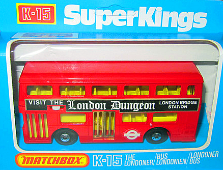
A toy bus from the late 1970s, advertising the then recently opened London attraction.
The dungeon’s suitably dank and dingy home beneath London Bridge station had originally been used as a storage facility for goods brought in via the Thames, where they would be stashed away before being hauled up to the rail network for further distribution across the country.
At first, the London Dungeon was essentially a waxwork emporium depicting London’s most notorious historical figures and brutal torture devices.
Personally speaking, I visited the attraction as a youngster; my abiding memory being that of an unfortunate mannequin, howling as he was slowly and repeatedly prodded into a giant cooking pot.
Over the years, the London Dungeon has morphed into something of a macabre theme park, complete with rides and actors. It vacated the original Tooley Street location in January 2013 and is now based in London’s County Hall.
Remnants from the original Dungeon however can still be seen below London Bridge Station…
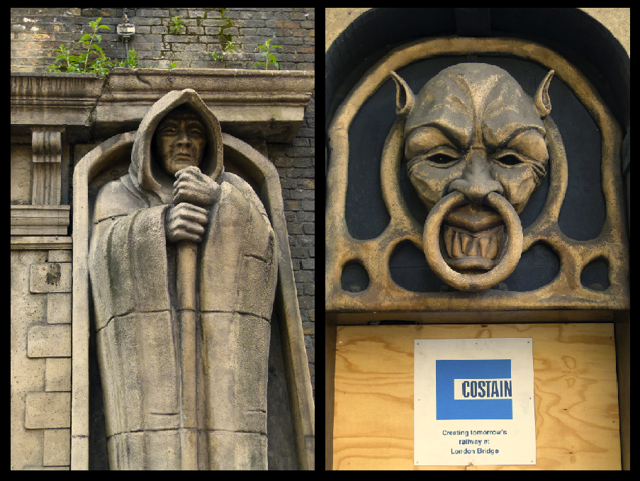
Remnants from the London Dungeon….
*
A little further along Tooley Street stand the original head quarters of the South Eastern Railway. Sadly, due to the major redevelopment of London Bridge Station, this historic building is currently under threat of demolition.

Old entrance to the former South Eastern Railway HQ.
For a number of years a wing of the former offices were occupied by the ‘Britain at War‘ museum which, like the nearby London Dungeons, have recently had to leave the area, leaving behind a few small reminders.
*
Druids and Crucifixes
As the line heads away from the chaos of London Bridge, the viaduct crosses Crucifix Lane and Abbey Street- references to Bermondsey Abbey; a Benedictine monastery which once stood in the area. Founded in the 11th century, the monastery remained until Henry VIII’s dissolution.
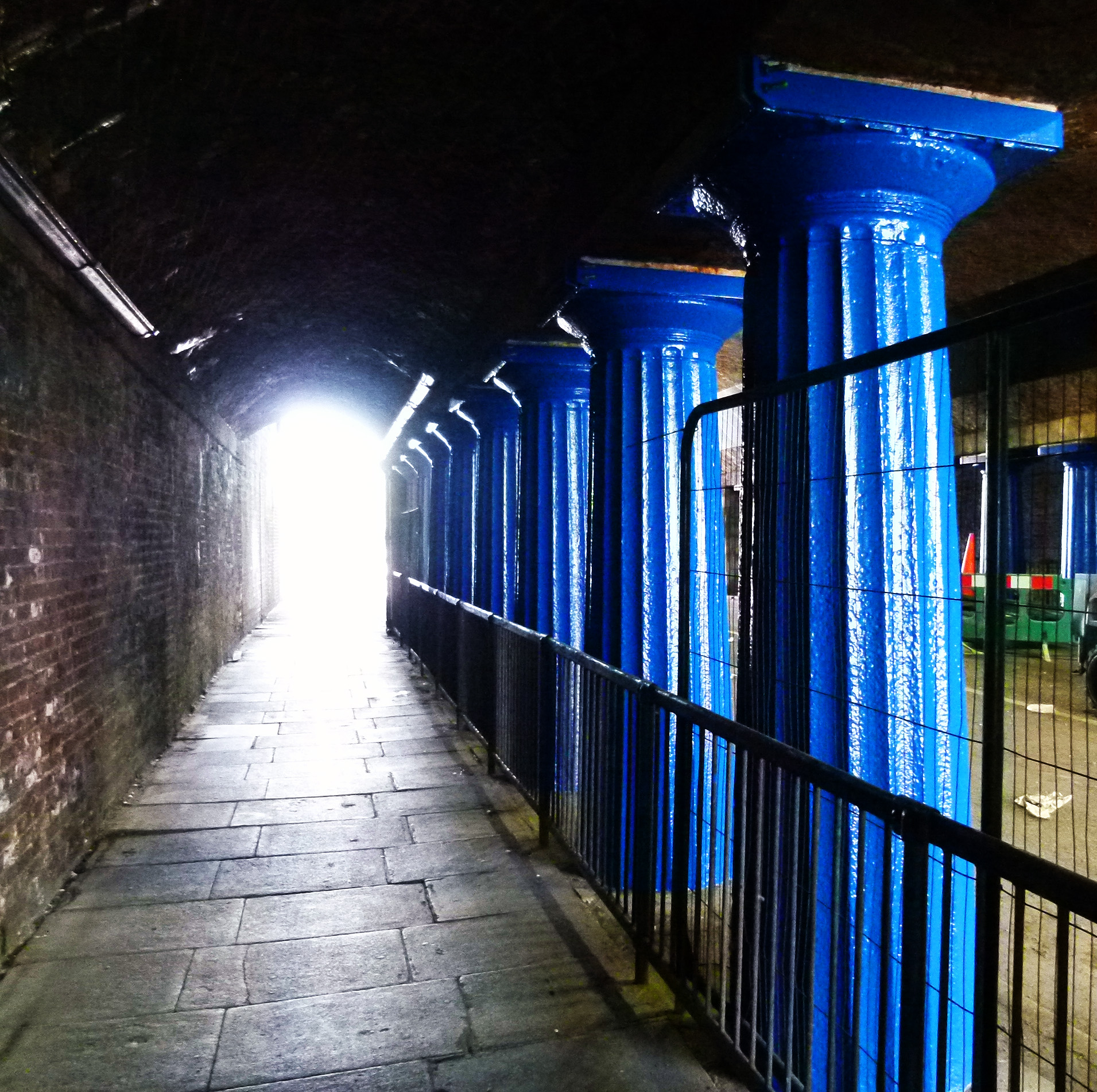
Ornate Doric columns beneath the viaduct on Abbey Street.
The viaduct also crosses Tower Bridge Road- at which point commuters can catch a glimpse of the famous, Thames crossing- and Druid Street; the site of another WWII calamity where, on October 25th 1940, the Druid Street arch- like that of Stainer Street- suffered a direct hit whilst packed with people seeking shelter.
77 people perished in the disaster.

Site of the Druid Street disaster.
Just across the road lies the St John’s Estate which runs parallel to the viaduct and where a faded sign indicating a WWII shelter can still be just about glimpsed.

Shelter sign on the St John’s Estate (image: Google Streetview).
Also located on Druid Street is the Alfred Salter playground, named after a kind hearted doctor who, along with his wife Ada, did much to help the impoverished people of Bermondsey during the early 20th century… despite the tragedy which struck their own lives.

Salter Park… the image in the corner is of Doctor Salter with his daughter, Joyce.
Please click here to read more about the Salters and their work.
*
Next door to the playground is the Downside Settlement; a pioneering youth club which has been open to local youngsters since 1908.
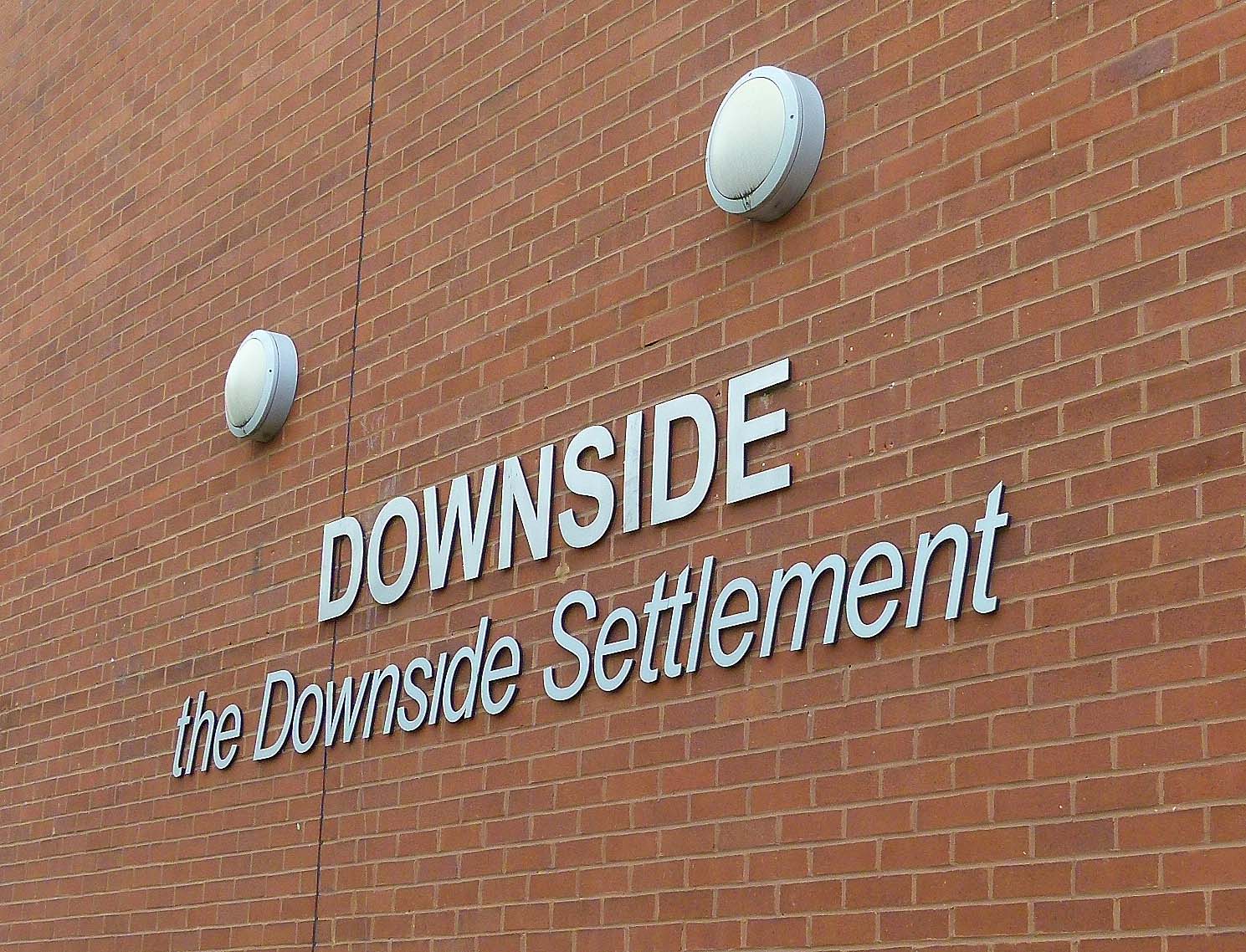
During the early 1980s, boxing matches staged at the club were televised on the fledgling Channel 4 in a show hosted by the late, great Henry Cooper.
*
Foul Times
Between Abbey Street and Crucifix Lane, the viaduct crosses Tanner Street- which was once known as Russell Street but has since been renamed as a reference to the leather trade which once thrived in the area.

Bermondsey’s old leather market, Weston Street (image: Google Streetview).
‘Tanning’ is the process in which animal skins are transformed into leather; a job which produces a notoriously foul stench due to the prescense of rotting flesh and the need for copious amounts of urine used to soak the hides.
Any scraps left over would be turned into glue; a process which produced further nasty odours.
In Victorian times especially, passengers chugging across the London to Greenwich viaduct would no doubt have been forced to close the windows as the train passed through the area.
*
It is perhaps no surprise that Bermondsey’s grim workhouse was plonked amongst the tanneries.
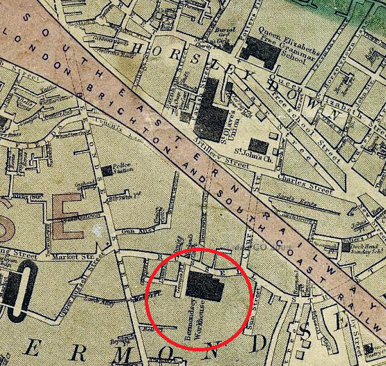
An 1860s map depicting the location of Bermondsey Workhouse.
Even by workhouse standards, the accommodation for Bermondsey’s paupers was shocking.
This was vividly illustrated in the autumn of 1865 when The Lancet reported that the building’s basement often flooded to a depth of two feet and that the “accommodation of the wayfaring class, or ‘tramps’” was “not fit for a dog”; the bedding being improvised from orange crates with no straw to lie on and a “wooden log for a pillow.”

Admission ticket for the Bermondsey Workhouse (image via The Guardian).
The ward for those who were infirm also came in for scathing criticism, being described as:
“very dirty, and deficient in both light and air. The occupants were the most thoroughly ‘pauperized’ set we have seen in any of our visitations, herding together in a miserable manner in the midst of conditions which must render any medical treatment in their chronic diseases of little avail. Their watercloset and urinal (abutting on the deadhouse) stink so offensively as to poison the whole atmosphere…”
*
A Lost River
A little further up, the viaduct passes near a road which is simply known as ‘Neckinger’; the name of an old London river which is now channelled underground.
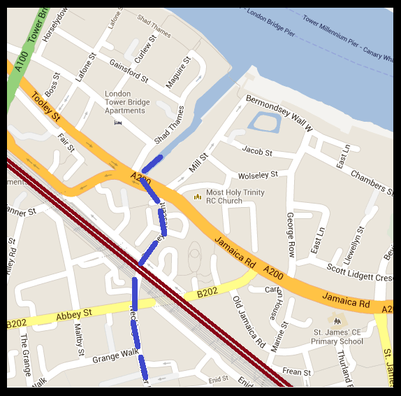
Map depicting the point where the railway viaduct crosses the subterranean Neckinger River (Map: Google).
‘Neckinger‘ is believed to derive from the term, ‘devil’s neck cloth’; a reference to the hangman’s noose- which is appropriate as pirates were often hung at St Saviour’s Dock where the river joins the Thames.
The area around St Saviour’s Dock (also known as ‘Jacob’s Island‘) featured in Charles Dickens’ Oliver Twist (originally published around the same period in which the London and Greenwich Railway opened) as the place where the vile Bill Sikes meets his untimely end (please click here to read more).

Bill Sikes- about to meet a nasty end near the mouth of the Thames…
*
Rouel Road… Stressed to Death?

Rouel Road (image: Google Streetview).
Rouel Road was once home to a boarding school which found itself at the centre of a rather bizarre case in October 1884, when it was reported in The Times that an 11 year old pupil; Master Adolphus James Davis died suddenly from alleged “over-pressure” from his studies.
Said to be “delirious”, young Adolphus “kept talking about his lessons, and repeating the words “I shall not pass” in allusion to an examination for which the school was preparing.
The coroner’s inquest into the death was held in the Bunch of Grapes pub on East Lane. In a statement which revealed much about conditions in the area at the time, schoolmaster, Seth Coward admitted that some pupils from the local area were “ill-clad and poorly fed” and that such “weak and delicate” boys “were expected to accomplish as much as the healthy and strong.”
Luckily for his teachers, it was agreed that Adolphus did not die from exam blues and a verdict of “death from apoplexy” was recorded.
Enid Street’s Communist Relic
Permanently parked on Enid Street as an advertising gimmick for one of the many garages which call the viaduct home, this little car is a ‘Trabant’; manufactured with little change in design between 1957 and 1990 in the former East Germany.

The Cold War comes to Enid Street…. an East German Trabant.
Often derided as being one of the worst cars ever made, the ‘Trabi’ as it was affectionately known was the most popular car in Eastern Germany- mainly of course because it was the only vehicle available to most of those living under the Communist regime.
In 1989, when the Berlin Wall finally tumbled, lots of these little cars were abandoned in the surge westwards.
Spa Road; Making London Transport History
When the London and Greenwich Railway first began serving the public in February 1836, the line was still very much under construction. The first working section to open was the stretch between Deptford and Spa Road… an arrangement which essentially made Spa Road the capital’s first ever railway terminus.

Plaque on Spa Road.
There have actually been two Spa Road stations. The first, which opened in the 1830s, was located near the junction with Rouel Road.

Spa Road Station in its earliest days. This drawing was made by Robert Blammell Schnebbelie; an artist who tragically died of starvation in 1849. (Image: Museum of London).
Built during an era when station design was still in its infancy, the original terminal was very basic indeed, consisting of two timber platforms connected to the street below by a rickety wooden staircase.
The ticket office was at street level and, as the image above illustrates, passengers were often required to queue on the stairwell whilst awaiting their train.
After the main terminal opened just over half a mile away at London Bridge, Spa Road’s passenger numbers suffered a significant decrease. In December 1838, it closed but opened again four years later following a refurbishment.
In 1872 the station underwent further change, moving 500 ft. south towards more substantial premises alongside Priter Way.

Spa Road Station in 1900 (image: Wikipedia).
The station ticked over until the outbreak of WWI when, faced with staff shortages and the on-going war emergency, Spa Road closed its doors for good on March 15th 1915, never to reopen again.
Dockley Road, beneath the derelict platforms…. the door seen on the right of this image was originally an entrance to Spa Road station.
Today, the ghost station sits quietly amongst a series of industrial units. Although closed to the public for nearly 100 years, the remnant still provides maintenance crews vital access to the tracks above.

The quiet remains of Spa Road Station…
The abandoned stairwells proved invaluable one night in January 1999 when two trains collided on the viaduct- the old Spa Road station being employed to evacuate over 200 stranded passengers to safety.
To be continued
Tales From the Terminals: Cannon Street Station

Perched on the north bank of the Thames between Southwark Bridge and London Bridge, Cannon Street station sits within an area particularly rich in history.

Over the Thames; the approach into Cannon Street station.
Roman Origins
Some 2,000 years ago, in the days when the city was known as Londinium, the patch now occupied by the station was home to a large Roman building known as the ‘Governor’s Palace’; an imposing administrative block, estimated to have been built circa AD80 to AD100.

The Roman Governor’s Palace (Image: Encyclopaedia Britannica).
This bureaucratic building is believed to have contained suites of offices and was accessible from the Thames via a wooden jetty. Some remains of this Roman site still exist deep beneath the railway terminal.
Candles and Cannons
By the medieval era, the road from which the station takes its name had become known as Candlewick Street on account of the numerous candle makers who lived and worked along the thoroughfare.

A medieval candle seller.
The present name, ‘Cannon’ is in fact a corruption of ‘Candlewick’ and has nothing at all to do with heavy weaponry!

An ornamental cannon outside Cannon’s Health Club which sits beneath the station… should’ve really been a giant candle stick!
European Enterprise
By the 10th century with the Roman office block long since crumbled, a major commercial base began to develop on the site.
Known as The Steelyard (derived from the German word, Stalhof meaning ‘trading base’), this large depot was owned and operated by the Hanseatic League; a powerful confederation of guilds originating in Saxony.
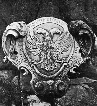
A Hanseatic Coat of Arms from London.
Dominating trade across Northern Europe for several centuries, the Hanseatic League was a precursor to today’s multi-national organisations. Their Cannon Street centre remained in use up until the 16th century.
Today, the Steelyard is commemorated in the names of two Thames footpaths; Hanseatic Walk and Steelyard Passage.

Running in a brick tunnel beneath Cannon Street station itself, Steelyard Passage is equipped with speakers which pipe out industrial sounds; atmospheric recreations of what one’s ears would have rung to in the days when the area served cargo ships rather than trains.
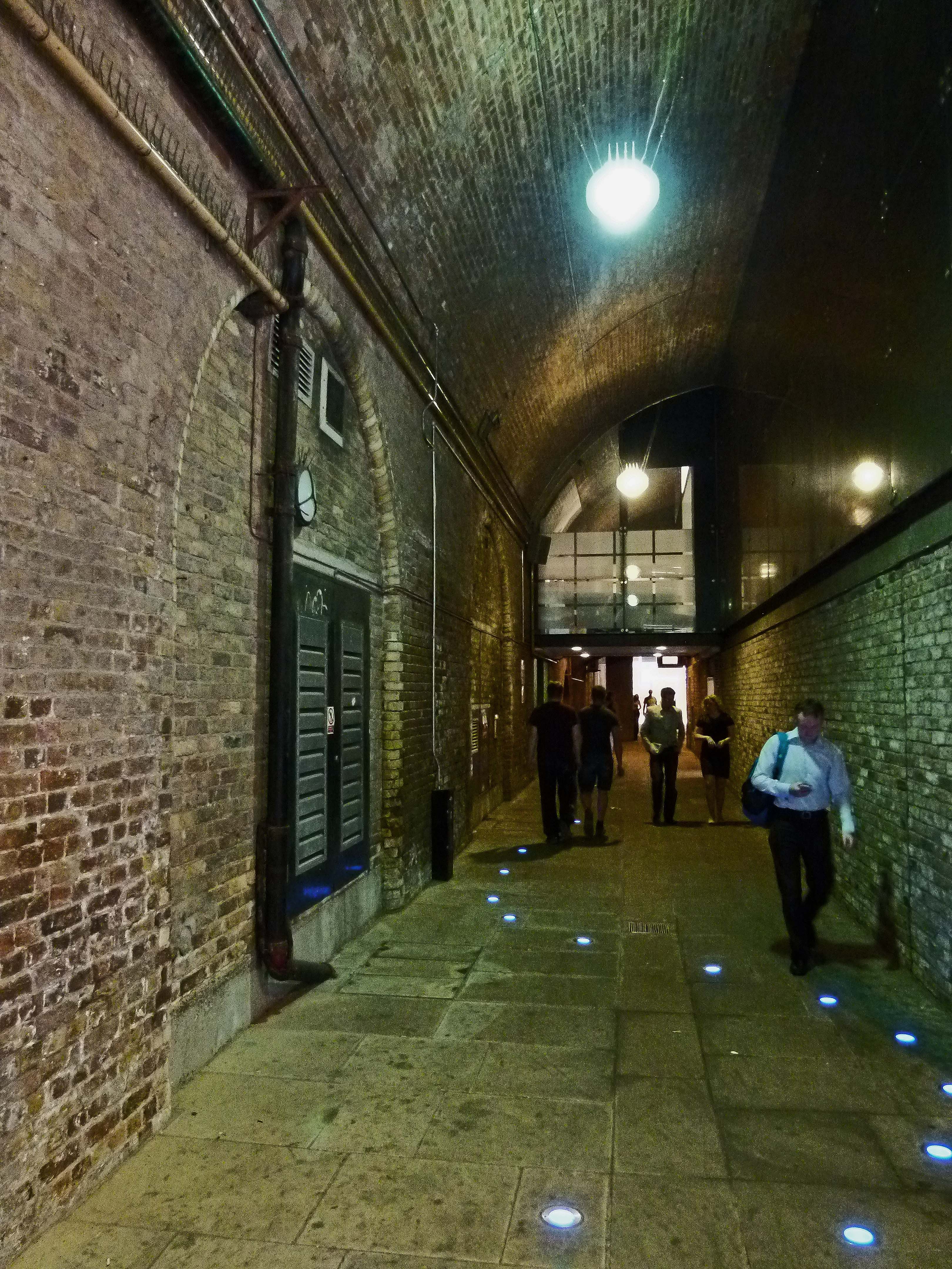
Steelyard Passage which runs beneath Cannon Street Station.
*
The Railway Arrives
Built as the London terminal for the South Eastern Railway, Cannon Street station opened on the 1st September 1866.
Designed by John Hawkshaw, the station’s first incarnation boasted towering walls and a soaring roof; 207 meters long and 32 metres high at its apex; “wider in a single span and longer than the roof of any other building in London” as a report from The Observer stated.

Cannon Street station in the 19th century.
The same article also praised Cannon Street’s signal box as being, “the greatest thing of its kind in the world. It extends from one side of the bridge to the other, and has a range of 67 levers.”
Must have been quite a headache to operate!

A selection of signal levers (Image: Geograph).
All of this technology however couldn’t prevent an embarrassing mishap which took place in 1926.
Shortly after leaving Cannon Street and crossing the Thames, a steam engine took a wrong turn on a viaduct. Led into a siding, high over Southwark’s Park Street, the driver slammed on the brakes… but it was to no avail; his metal steed smashed through the buffers and straight into the roof of Barclay and Perkins’s brewery!

Location of the 1926 brewery crash, Park Street Southwark. The area is now home to the ‘Vinopolis’ wine attraction. (Image: Google Streetview)
The 60 tonne engine ended up dangling 8 feet above the brewery’s vat room. Luckily, nobody was injured but the subsequent debris resulted in the tragic loss of over 200 barrels of beer!
A Grand Hotel for the City
One year after the station opened the Cannon Street Hotel was added to the fledgling terminal. Designed by E.M Barry- son of Charles Barry, the main architect behind the Houses of Parliament- this new addition blessed the station with an extremely elegant façade.
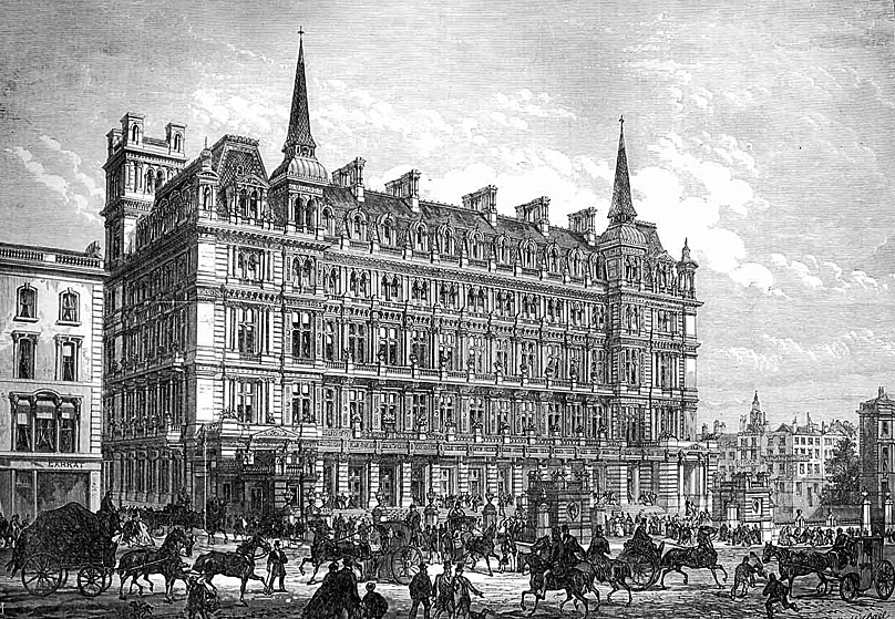
Cannon Street Hotel as pictured in the ‘Illustrated London News’.
In its day, the Cannon Street Hotel was a popular venue for meetings and conferences; many of which proved to be turbulent and overheated. It was here, in July 1920, that the British Communist Party was founded, no doubt encouraged by the revolution in Russia which had taken place three years previously.
In 1927, whilst attending a dinner at the hotel, politician David Lloyd George had his expensive overcoat stolen from his room. The thief was promptly collared in the main lobby but the former Prime Minister was so moved by the “pathetic story of distress related by the thief”, that he insisted the misguided fellow be set free.

David Lloyd George…the former PM who displayed compassion at the Cannon Street Hotel. (Image: Wikipedia)
In the 1930s, the hotel bedrooms were converted into office suites. This new scheme did not last for very long however- the grand building was destroyed during the Blitz.
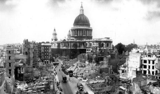
This view of St Paul’s from the vicinity of Cannon Street demonstrates the devastation suffered in the area.
Another casualty of WWII was the station’s celebrated glass roof.
When hostilities broke out in 1939, the wide expanse of panes had been carefully removed and taken to a factory for safekeeping… unfortunately, this supposedly safe haven was itself bombed, taking the stacks of glass with it.
*
Post-War
Scarred by bombs and with its roof lost, Cannon Street was in a sorry state following WWII.
As the rare image below, taken in 1957, shows, the lack of glass meant the terminal was open to the elements, requiring shelters to be built on the platforms.

Cannon Street, March 1957. (Copyright A.Taylor/ Hastings Diesels Collection. Many thanks to hastingsdiesels.co.uk)
The station remained neglected until the 1960s when the terminal was redeveloped in a style typically modern of the time.
The main element of this scheme was a large office block, replacing the old frontage once occupied by the Cannon Street Hotel. The skeletal, glassless iron frame of the old roof was also dismantled.
Cannon Street’s 1960s facade by John Poulson. (Image: Wikipedia)
The new offices were designed by John Poulson… whom it was later discovered won the contract thanks to backhanders and a shady friendship with Graham Tunbridge; a surveyor for British Rail. Tried for corruption, the pair were found guilty- landing Poulson a seven year prison sentence.
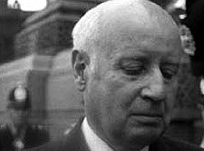
Dodgy dealings… John Poulson (image: BBC)
With financial markets booming, further office space was added in the 1980s and the station’s famous towers were treated to a full restoration. A bold scheme to add a helipad, first mooted in the early 1960s, was also revived.
However, with the promise of up to 70 helicopters buzzing in and out of Cannon Street every day, grave concerns were raised as to the potential noise levels and their effect on offices and services at nearby St Paul’s Cathedral.
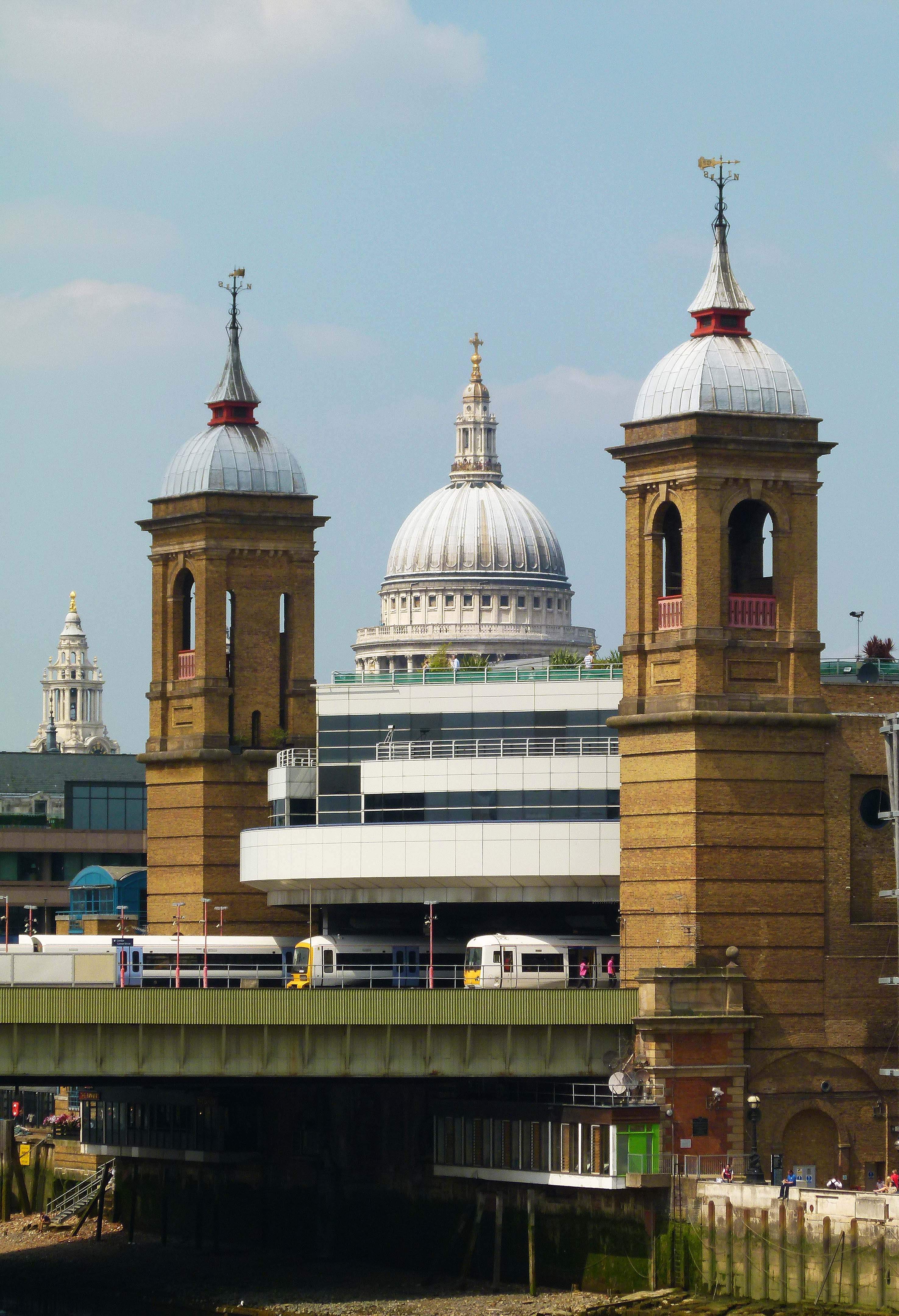
Three towers… Cannon Street and nearby St Paul’s Cathedral.
In 1990, the issue was raised in Parliament, with one MP suggesting that “the proposal is an utter disgrace… uncivilised and wrong.” Needless to say Cannon Street’s heliport never came to fruition.
*
Bombs and Crashes
During the morning rush hour of 4th March 1976, regular passengers from Sevenoaks into Cannon Street had an extremely lucky escape when a 10lb IRA bomb exploded on a train.
Miraculously, the train was empty; the device detonating as the carriages pulled out of Cannon Street shortly after unloading 100s of people. Eight people on a passing train suffered minor injuries.
Had the bomb gone off just thirteen minutes earlier the results do not bear thinking about.

The bombed carriage which was mercifully empty.
*
Another shocking rush hour incident occurred on the morning of the 8th January 1991 when a train rolling into Cannon Street failed to stop, crashing into the buffers.
Although only travelling at 10mph, the impact had devastating results, turning the carriages into a crumpled mess.

The shocking result of a 10mph shunt (image: BBC).
Two passengers; 59 year old Patricia McCay and 24 year old Martin Strivens were killed and a further 542 were injured. With many people trapped in the tangled mess, rescue teams had to battle for 15 hours to cut people out.

Rescue teams at Cannon Street, January 1991. (Image: The London Fire Journal).
During the inquest, it was discovered that two of the coaches involved had under bodies dating back to 1928 and 1934. Although the main bodywork had been rebuilt over the years, the bases of these carriages had become perilously weak, forcing the main compartments forward like a pack of cards in the low-speed shunt.
Cannon Street Today
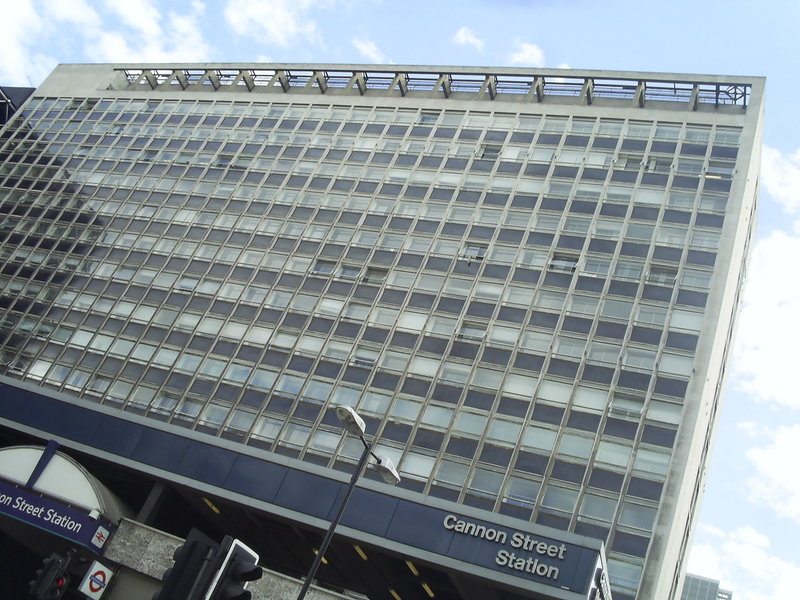
In recent years, Cannon Street has once again undergone dramatic change.
Poulson’s 1960s block was swept away in 2007 as part of a £360 million project to revamp the terminal. Designed by US developer, Hines, Cannon Street’s latest look consists of 400,000 square ft. of gleaming office space accompanied by a further 17,000 ft. of retail space.
Cannon Street station today.
The once celebrated space above the platforms has also found a new lease of life… having been transformed into a stunning rooftop garden!

Cannon Street station’s rooftop garden (image: Tropolis).