Candid Capital: Hampstead Fog
Hampstead Fog
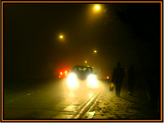 Fitzjohn’s Avenue on a murky, autumn night. November 2011.
Cabbie’s Curios : Covent Garden’s Cramped Alley
Pictured below is the London Coliseum (home to the English National Opera), which is located on St Martin’s Lane, Covent Garden.
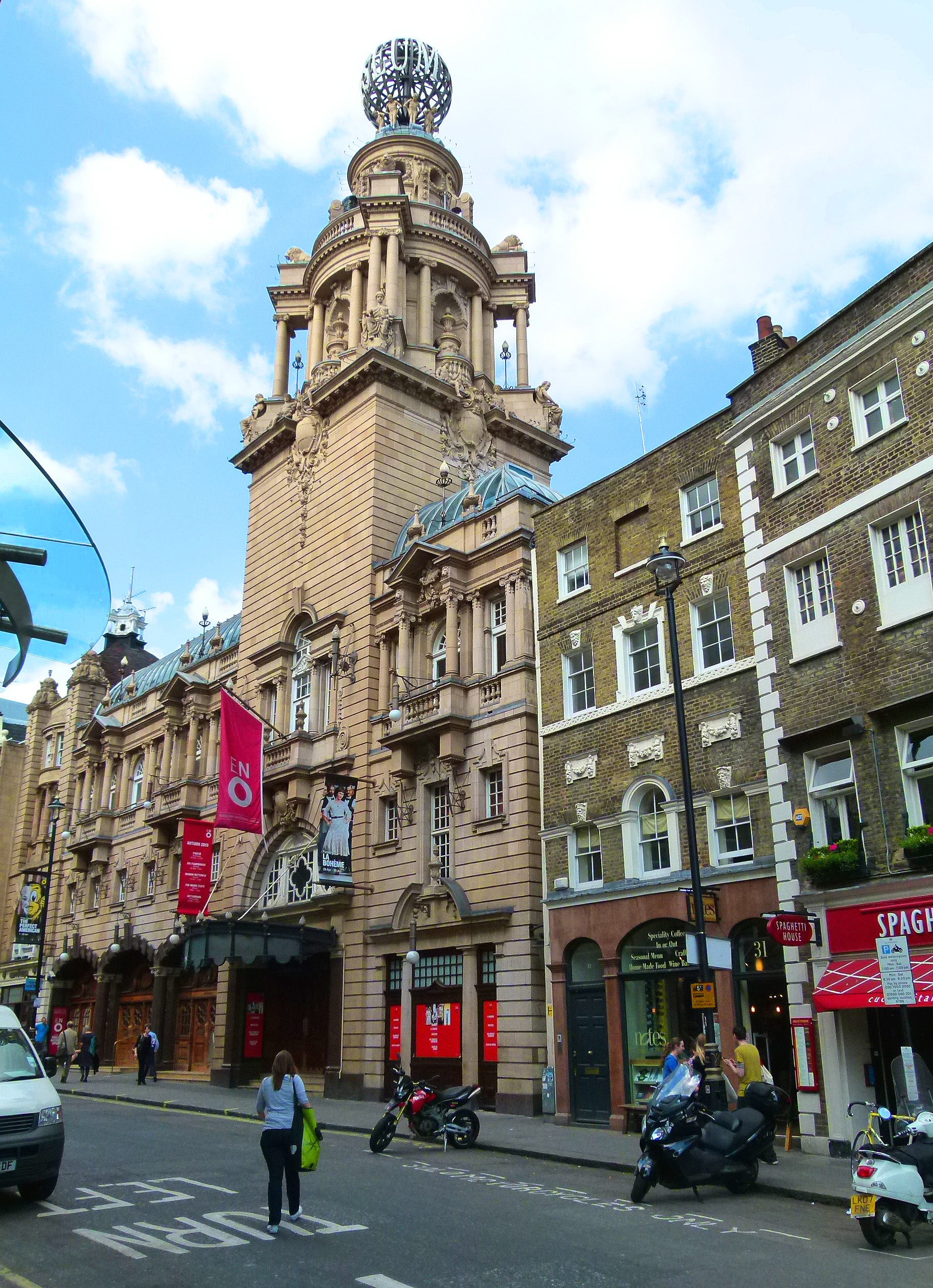
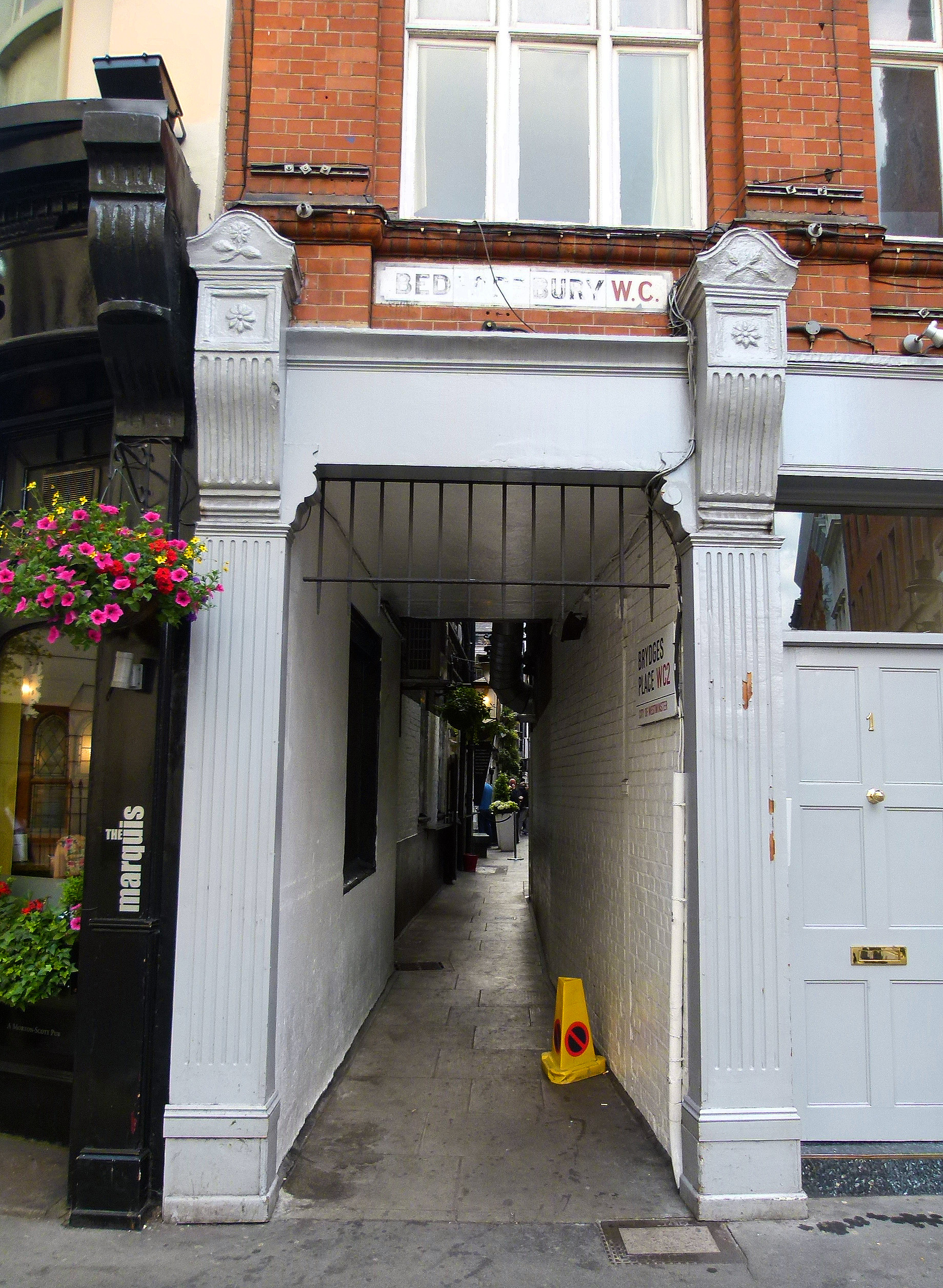
Did you notice the hidden alleyway?…

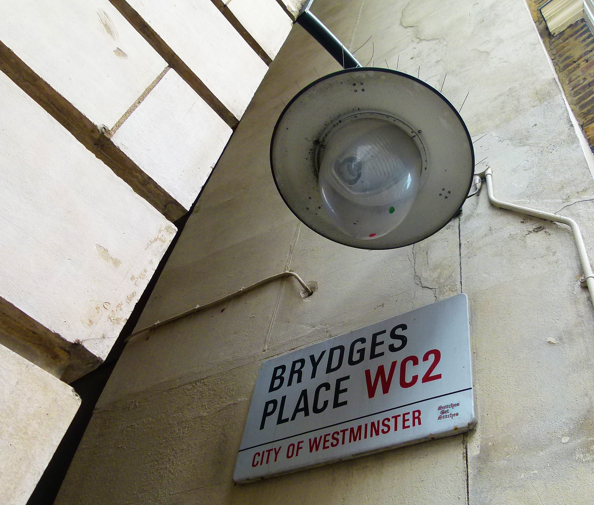
Location of the diminutive alleyway…
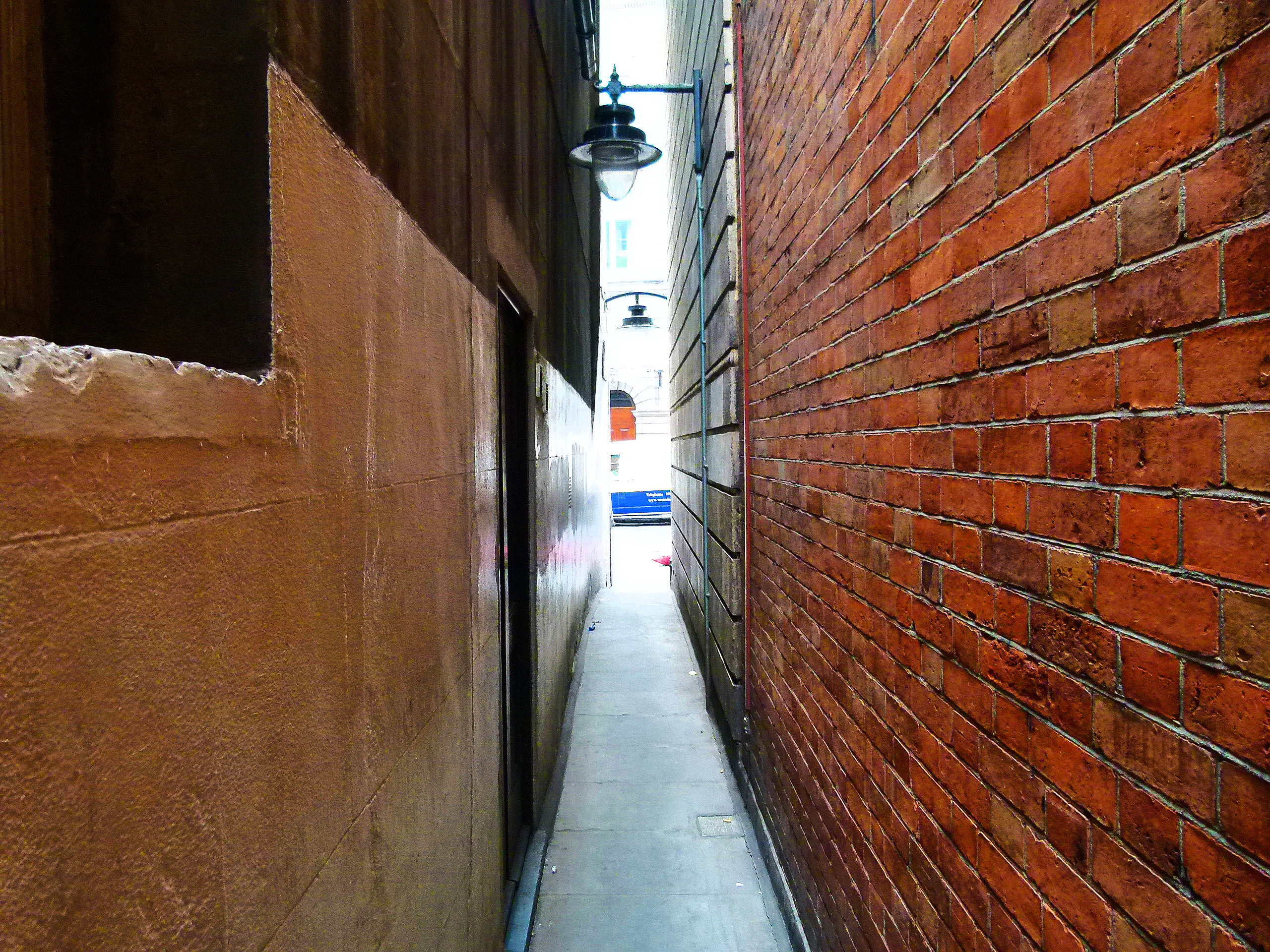
Running for approximately 250 ft. this secretive passageway is called ‘Brydges Place’ and provides pedestrians in the know with a quick link between St Martin’s Lane and Bedfordbury (just behind Charing Cross Police Station).

Brydges Place – St Martin’s Lane entrance.
At its tightest point, Brydges Place is just 15 inches wide, making it London’s narrowest alley- so is best avoided if you suffer from claustrophobia.
Brydges Place is named after Catherine Brydges of Chandos who married the fourth earl of the Bedford Family in 1608 (the Bedford family being the original owners of the land occupied by Covent Garden).
The Bedford dynasty gave their name to a number of streets in Covent Garden and, at one time, part of Catherine Street (home to the Duchess Theatre and the Theatre Royal) was known as Brydges Street.
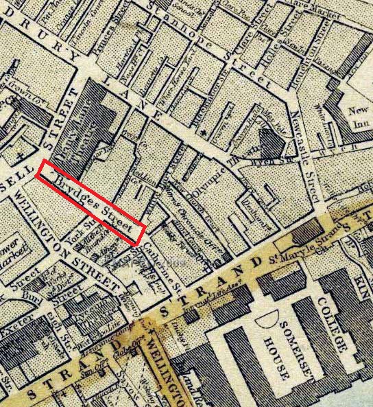
Brydges Street (now entirely named Catherine Street) on a map from 1868 (image: mapco.net)
Brydges Place as it stands today was created at the turn of the 20th century when the London Coliseum- which provides much of the alley’s northern wall- opened on Christmas Eve 1904.

However, a passageway covering this ground is nothing new- an alley had existed on the site long before its present incarnation and was known as ‘Turners Court’ before morphing into Brydges Place.
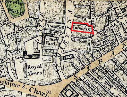
Turners Court…. note; the area labelled ‘Royal Mews’ in the bottom left hand corner of the map is now covered by the National Gallery.
On 15th August 1885, The Times carried a sad report on Mr Dennis O’Malley, a 73 year old sandwich-board man who lived and died in a tiny home on Turners Court.

A narrow window looking out on Brydges Place.
The flat- which Dennis O’Malley shared with his son- was described as a “front room in the basement” of a house into which another 14 people were crammed.
Mr O’Malley was “found lying dead on a kind of bed on the floor. The stench of the room was abominable.”

Dr Samuel Mills, who was called to the scene, stated that “he was not aware that such a place in Bedfordbury existed”…
Brydges Place Bedfordbury exit.
*
Today, the only active premise to be found tucked away on Brydges Place is the aptly named ‘Two Brydges Place’; a discreetly private club popular with those who work in the theatre and media (Simon Callow is a noted member).

A group of drinkers gather outside Two Brydges Place.
Two Brydges Place was established in the early 1980s by Rod Lane, an entrepreneur who founded the club on “the basis that I didn’t like going to places where people clicked their fingers at the waiters.”
Sounds like my kind of place!

WWI 100: London’s Memorials… Cyprus Street
![]()
Cyprus Street Memorial
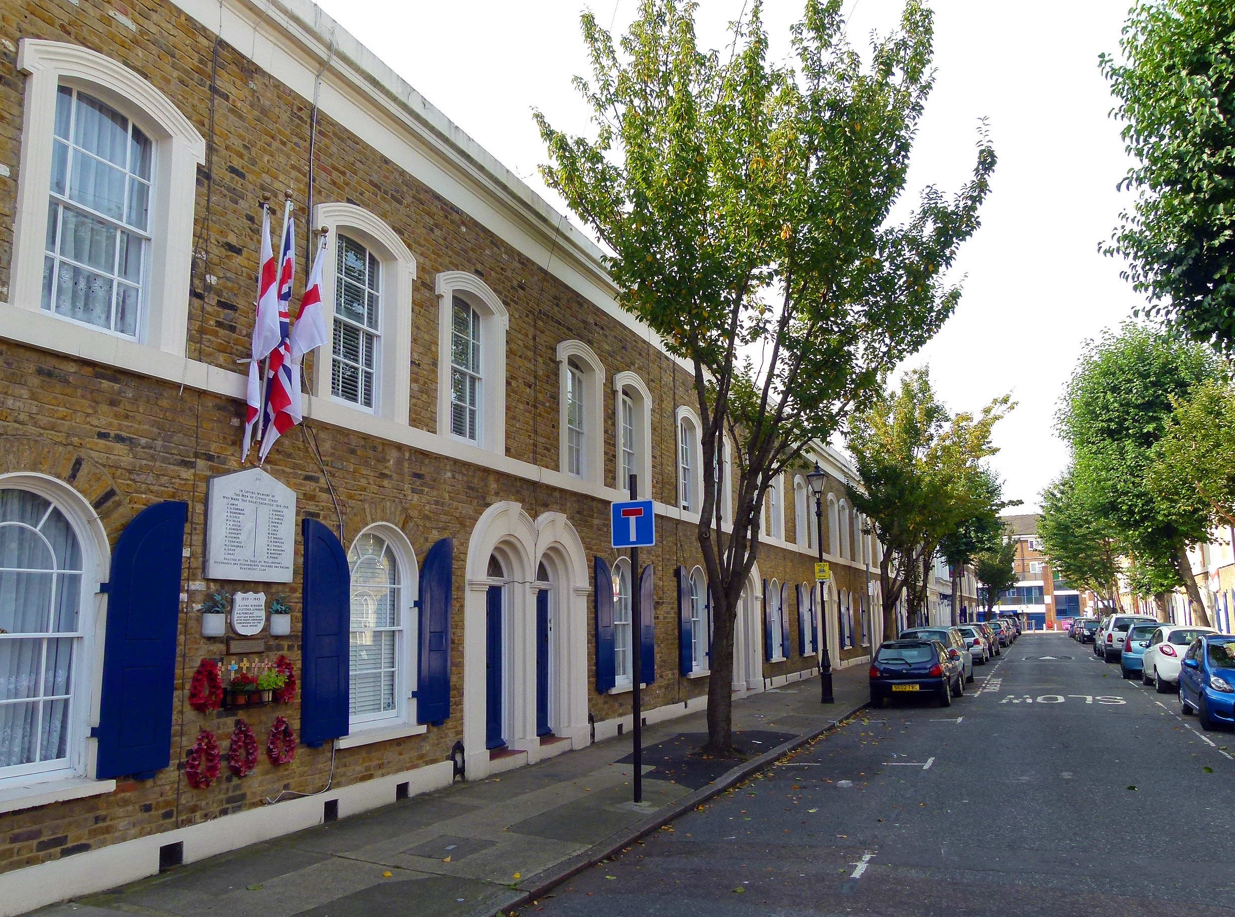
Cyprus Street, Bethnal Green
Across the UK, most of the memorials dedicated to those who perished in WWI were created in an official capacity.
However, right in the heart of London’s East End (Bethnal Green to be precise) on a quiet road called Cyprus Street, there stands a memorial which is somewhat different…

The Cyprus Street Memorial.
As the Great War raged between 1914 and 1918, memorials similar to the one on Cyprus Street became a common sight across Britain; unofficial shrines to local men who had been killed in battle.
Such sanctums were erected on a temporary basis and were later replaced by grand, official memorials in the years following the armistice.
The Cyprus Street plaque was originally paid for by the Duke of Wellington’s Discharged and Demobolised Soldiers and Sailors Benevolent Club; a group who were based at and took their name from a local pub.

After the war, the Cyprus Street memorial was maintained for a special reason: the 26 East End lads named on the plaque represented the highest loss to hit a single London street.

In the 1960s the Cyprus Street memorial was nearly lost for good when the local housing association decided to plonk a modern block of flats on the site.
During the demolition of the house upon which the memorial was located, the plaque was damaged. Thankfully the pieces were rescued and stashed away in a pub for safekeeping.

1960s flat blocks on Cyprus Street- the building on the left marks the original site of the WWI memorial.
Following this callous blow, the local tenants association clubbed together to fund a replica- the version which can be seen today, a short distance from its original location.
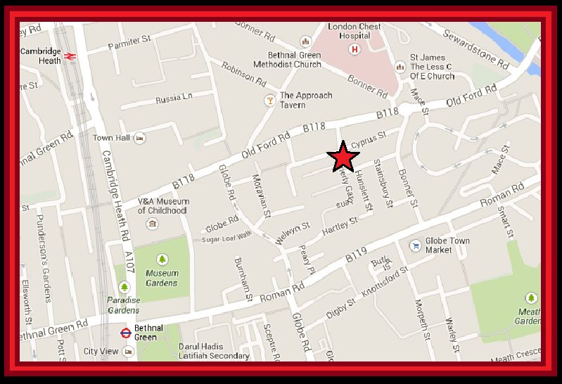
Location of the Cyprus Street memorial as it appears today; about 500 ft from the original site.
Today, the Cyprus Street memorial is lovingly maintained by two elderly locals; Ron Sale and Dave Stanley who hope that their work will be taken on when they are no longer around to do so.